
Punta Lameda Lighthouse
About this heritage
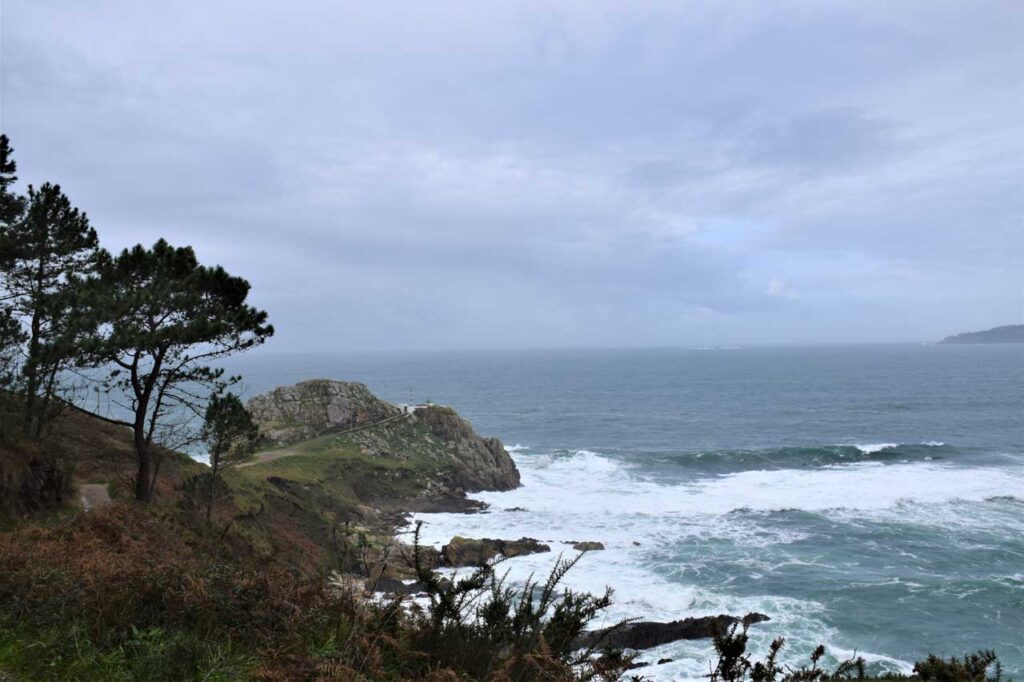
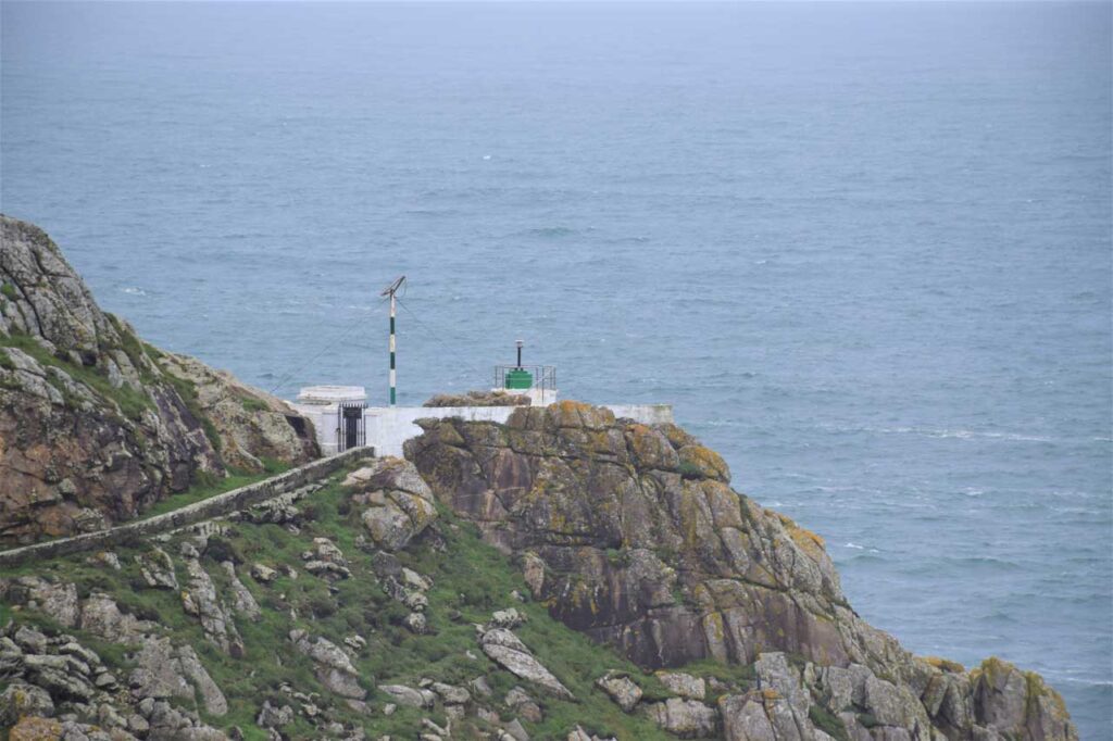
The Punta Lameda lighthouse is located on the Monteferro peninsula in Nigrán. It is a small building on the stone peak at about 27 metres above sea level. It has a striking green light that controls the area at nightfall.
From this lighthouse you can see a beautiful panoramic view of the estuary and ahead, one can contemplate the majestic Cíes islands belonging to the Maritime-Terrestrial National Park of the Atlantic Islands of Galicia.
Here you will find one of Monteferro's hiking sectors: the Faro (Lighthouse) sector, which is regularly visited by hikers from the surrounding areas. Other sectors are Porto escondido and Illas Estelas.
At the end of the 1930’s a military battery, now in ruins, was installed on the northwestern slope of Monteferro.
It can be reached by following the Senda Azul Litoral Playa América - Panxón Route, which runs along the town' s coastline from El Ramallosa, crossing Playa América, Panxón and Playa de A Madorra, going up to Monteferro from Fofa to the military batteries. Once there the path provides the option of either going down to the lighthouse or up to the Monteferro viewpoint.
Another way of getting there is from the road that goes up to the top of Monteferro, at 1.2 Km from the junction with the Panxón road - Playa de Patos. Just before this slope there is a dirt track to the right. Then follow the path and take the track to the right again in a descending direction.
To learn more
The peninsula of Monteferro is a segment of earth and rock that extends into the sea by nearly 1.5 km and occupies an area of more than 100 hectares. The altitude of the hill is 147 meters and is covered by a forest of mainly pine and eucalyptus trees. It is called Monteferro because of the abundance of this mineral (iron, ferro in Galician)which is most probably what attracted the ancient inhabitants of the area.
The cliffs surrounding the mountain make it impossible to have large beaches, but there are small coves such as Portocelo and Rocas Blancas on the southern slope.
At the top there is a monument that represents the Virgin of Carmen, patron saint of sailors, Monument to the Universal Navy or also known as Monument to the Martyrs of the Sea.
It is a 25 metre high granite construction created in 1903 by the Vigo sculptor Manuel Gómez Román and inaugurated in 1924 during the dictatorship of General Miguel Primo de Rivera.
The purpose of this monolith was that sailors returning to the peninsula would be greeted from afar by this immense image.
On the northwest slope, stand the remains of an abandoned military base, which are the ruins of the J3 Batteries of Monteferro that were installed at the end of 1930. It received cannons from different points of Galicia and its objective was to defend the coast against a possible invasion by foreign countries after the Second World War.
It consists of six constructions arranged in linear form. At the top of the mountain, the remains of a construction with anchors for a possible piece of artillery, were found.
In the 60's they were discharged and the abandonment made that the buildings became deteriorated.
To know it better
The Punta Lameda lighthouse is located in Monteferro, on the coast of Nigrán, and has spectacular views of the Cíes islands, the Estelas islands and the Vigo estuary. In fact, from the lighthouse, the South Island or San Martiño de las Cíes, is just over 5 kilometres away. In addition, from the Punta Lameda lighthouse you can also see Cabo Home and the coast of O Morrazo.
Punta Lameda or da Meda is found in a low rocky terrain surrounded by cliffs and rocks. Many of its caves were created over the years, by the waves and the force of the sea.. At the top there is the small lighthouse of Punta Lameda, which is illuminated at dusk with a green light to indicate land approaching.
Galería
Location
- Locality
- Panxón
- Municipality
- Nigrán
- Province
- Pontevedra
- Country
- Spain
The asset
- Type
- Lighthouse
- Eco-destination
- Ría de Vigo
- Environment
- Natural
- Relevance
- Regional
How to get there
- Access
- By sea
- Port
- Puerto de Panxón
- Distance
- Caminando desde el puerto de Panxón: 43 minutos. Distancia en coche: 10 minutos
The visit
- Visitable
- Only outside
- Interpretation
- Do not
- Accessible
- No
- Parking
- Sí
- Signposted
- Yes
Coordinates
- Latitud
- 42.15658600
- Longitud
- -8.84975100