


Illa de Arousa. Carreirón Natural Park
About this heritage
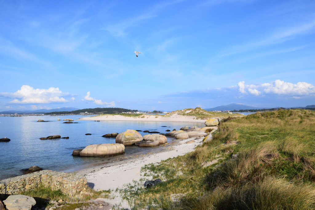
The natural space of O Carreirón is located in the southern part of the Arousa island, in the province of Pontevedra. Punta Carreirón and its lagoon are a privileged place for birds, not in vain is recognized as an international zone of special protection for birds (ZEPA), by the European Union and its integration into the Intertidal Complex Natural Park of Umia – O Grove – A Lanzada – Punta do Carreirón and Lagoa de Bodeira.
The area has specially designed booths for bird watching, from which photographers and nature lovers enjoy the most spectacular moments offered by the different birds that visit the park. The natural park is actually a peninsula linked to the Arousa island by the Saline tombolo, which measures 1.3 km2.
Flora, fauna, rocks, pure landscape, this is how the Arousa island is, 36km of coastline of which 11 are beaches with fine white sand, such as the beach of Sualaxe with its 174 meters long and 30 meters wide is flanked by a pine-forest and very close to the lighthouse of Punta Cabalo, or the Cabodeiro beach, one of the most visited of the island.
The marine resources are the main source of income for the inhabitants of the island, highlighting the mussel sector in the seafood and other fishing gears that are also important.
To learn more
The Arousa island is a must stop if you are visiting the Arousa estuary. It is located 70 km away from Vigo and 62 km from Santiago de Compostela. If you are coming from Vigo, you must go in Sanxenxo´s direction and from there to Ribadumia in Cambados´ direction, you can arrive from there without any problems just following the indications.
From Santiago de Compostela, we have to go in Pontevedra´s direction, Vilagarcía de Arousa and from there, following the PO-549 we just need to follow the indications. The island is located approximately 12 km away from Vilagarcía.
The Arousa island has four ports, all of which are used for unloading mussels, clams and fish, in addition to other sea-related activities.
To get to the island it is necessary to cross the bridge that joins the island with Vilanova de Arousa, this bridge was built in 1985 and its 1980 meters long.
If you are fan of hiking or bicycle routes, the island has different sections for bicycle touring which border almost the entire island.
As for the hiking routes, we can mention two: “A ruta dos Condes” (Counts´s route) of 7 km and which runs through the entire town, and is divided into north and south areas. The other route is “A Ruta dos Pilros” (Curlew sandpiper route), a shorter one, between two and three kilometres, it starts at Punta Carreirón and continues bordering the coastline of Brava´s cove, where the afore-mention bird observatories are located.
To know it better
In the heart of the Arousa estuary is the famous Arousa island (Arosa island in Spanish), located in the province of Pontevedra. It is home to 7.000 inhabitants, the vast majority of whom are engage in fishing, mussel farming and shell-fishing.
The most interesting places in Arousa are the surroundings of the lighthouse, Guidoiro Areoso Island (close to Arousa island) and Carreirón Natural Park. This park is classified as a special protection area for birds (ZEPA), as there are grey-heron populations on the island, among others. This species are largue birds that are usually perched on the shores.
Carreirón park, which is part of the Intertidal Complex Natural Park, has unique beaches, calm waters and large trees. In addition, it has dunes systems, marshes, bushes and pine-forests.
Gallery
Location
- Town
- A Illa de Arousa
- Municipality
- A Illa de Arousa
- Province
- Pontevedra
- Country
- Spain
The asset
- Type
- Natural Park
- Eco-destination
- Ría de Arousa
- Environment
- Natural
- Relevance
- International
How to get there
- Access
- By sea By land
- Distance
- 5,400 km
The visit
- Visitable
- Yes
- Interpretation
- IT HAS INFORMATIVE PANELS AND INFORMATION POINT
- Accessible
- Sí
- Parking
- Sí
Coordinates
- Latitud
- 42.53026600
- Longitud
- -8.87177900