


Cangas. Barra beach
About this heritage
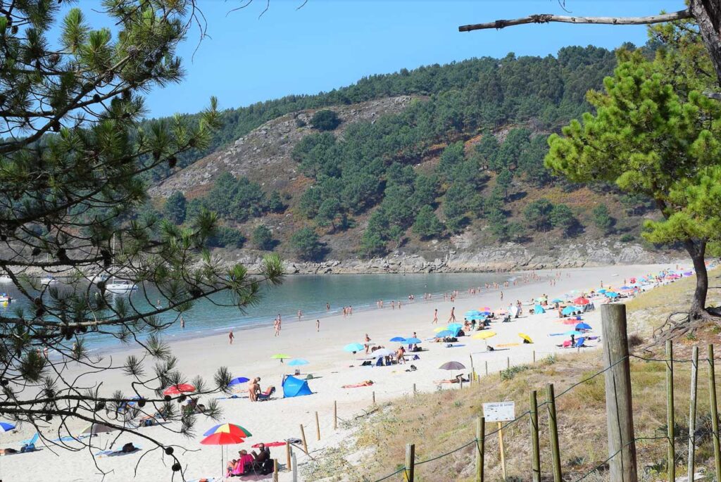
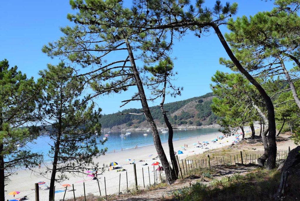
Barra beach is the third beach of Nerga´s cove, it belongs to Cangas and it is also located in a protected area of the Natura Network 2000. Its length is 750 metres, its sand is white and it has a moderate swell. It has an anchoring area.
It is one of the best nudist beaches and it also has a lifeguard service. The beach has a large native pine forest that reaches the sea.
As it is a protected area and not accessible by car, it allows a greater privacy.
From Barra beach you can access the Cabo do Home Lighthouse. Cabo Home and Costa de la Vela (home in Galician means man and in Spanish is pronounced "ome") are located in the Morrazo Peninsula, between the Vigo and Pontevedra estuaries. A unique enclave bathed by crystal clear waters and legends of sea monsters.
We are in an area of unquestionable natural value, due to its diversity of flora and wild species and a great landscape value provided by its capes and cliffs forming a unique visual spectacle.
The route, which we can start in Cangas, will take us through different wild beaches such as Nerga beach with its dune complex and calm waters. Barra beach, a nudist beach par excellence in the Rías Baixas, can be accessed by unpaved tracks. It is a sandy area of more than one kilometre that we will leave behind to reach the beach of Melide, smaller but just as charming.
To learn more
Barra beach is located south of Cabo Home, and is one of the first beaches where nudism was allowed in Galicia. It stands out for its Caribbean beauty, crystal clear waters, fine sand and a pine forest that reaches the beach itself. Without a doubt a beach from which to contemplate the wonderful sunset of the Galician estuary.
Cabo Home has two lighthouses that can be accessed on foot by any of the paths that run through the area.
Cabo Home lighthouse is a slender tower painted white in contrast to the neighbouring Punta Robaleira lighthouse tower painted red. It reaches a focal plane of 38 metres above sea level and emits flashes every 3 seconds which, as we have already mentioned, is visible from 9 miles away. Very close to this lighthouse (almost a stone's throw away) we find the lighthouse of Punta Robaleira, which reaches a focal plane of 27 metres above sea level. Its white and red light of sectors - in group of 2 flashes every 8 seconds and range of 11 and 9 miles respectively - beacon low as the stone La Redonda, the Capetudos and the many petons that Punta Robaleira sends out.
To reach Costa da Vela, we have to get to the town hall of Cangas, at the western end of the peninsula of O Morrazo (Pontevedra). It has an area of 1,384.81 hectares, of which 1,003 hectares are marine waters. To access it is necessary to take the PO-551 detour between Bueu and Cangas towards Hío or south through Donón.
O Morrazo Peninsula is a tourist area, where you will find all the leisure options and all the necessary services to enjoy both a long holiday and a weekend break.
To know it better
In the westernmost part of the Morrazo, you will find Cabo Home with a lighthouse dating from 1853. About 17 meters high, the tower is 143 meters above sea level. The Morrazo peninsula stands out for its beaches with crystalline waters and fine white sand.
Barra beach is a wide sandy area that occupies about 750 metres. It is located in the Vigo estuary between Punta Creixiña and Punta Corveiro dos Castros and Punta Subrido or Fuxiño. It is a windy beach with moderate waves and cold water. It is part of the protected area and belongs to the Natura Network 2000. Besides, nudism is allowed, which makes the occupation medium-high.
Cangas is a municipality in the province of Pontevedra that belongs to the Morrazo region. It is divided into five parishes: Aldán, Cangas, Coiro, Darbo and Hío.
Gallery
Location
- Town
- Nerga - O Hío
- Municipality
- Cangas
- Province
- Pontevedra
- Country
- Spain
The asset
- Type
- Beach
- Eco-destination
- Ría de Vigo
- Environment
- Natural
- Relevance
- International
How to get there
- Access
- By sea By land
- Distance
- 8,1 km
The visit
- Visitable
- It can be visited all year round
- Accessible
- No
- Parking
- Sí
Coordinates
- Latitud
- 42.26129600
- Longitud
- -8.85159000