
Goián. Goián´s Fortress
About this heritage
Goián is a parish in the municipality of Tomiño that belongs to the Baixo Miño (Lower Miño) region.
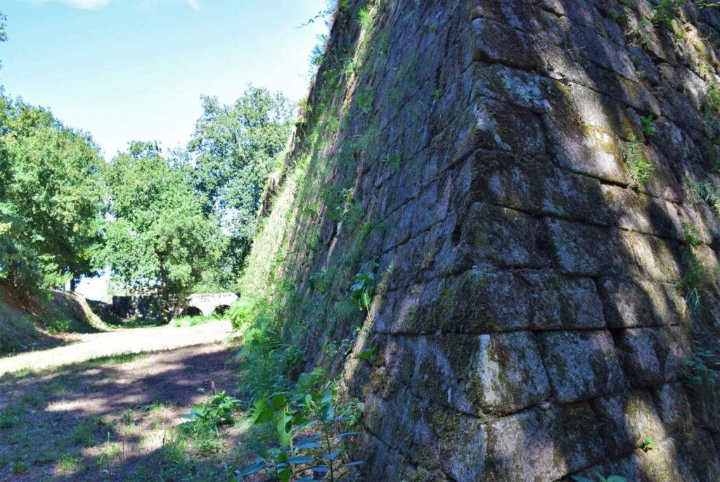
Goián´s Fortress or San Lourenzo is located on the Miño river´s banks. It dates back to the 17th century and is a star-shaped fortification built of granite. The origin of this fortified enclosure was the result of continuous historical confrontations between the Spanish and Portuguese.
In 1663 Goián was invaded by the Portuguese and they occupied an old enclosure called “Fortín da Barca”, which was abandoned after the Lisbon Peace Treaty, in 1668.
Three years later, the current fortress was built in the same enclave, by order of Mariana de Austria. The mission was to control a pier - in the neighbouring country - and keep a watchful eye on Vilanova de Cerveira square, preventing possible conflicts, once the Restoration War was over. This Portuguese village was just in front.
The fortress was covered by undergrowth for many years, disuse helped to make it as one of the best preserved enclaves on the border with Portugal.
Thanks to the collaboration of the parish´s neighbours and the Eliseo Association of Goián, this now catalogued Asset of Cultural Interest (BIC) was put to good use and the public use of this environment was recovered.
Designed by the architect Pablo Gallego Picard, the “Espazo Fortaleza” (Fortress space) was opened to the public in 2012 and it was awarded with important architectural, landscaping and urbanism prizes.
This fortress has become one of the most popular places in the municipality as it is a good place to walk, enjoy its river beach in summer and contemplate the views of both banks of the Miño river. It also has a children´s playground, a bar and an information point where it is possible to arrange guided tours.
To learn more
The San Lourenzo Fortress is included in the Goián – Vilanova de Cerveira border system in Portugal. Dating from the seventeenth century, it´s located on the Miño river´s banks and is a star-shaped fortification built in granite. It has a rectangular floor plan with four bastions at the corners, each of which had three sentry boxes.
There is nothing left on the old premises inside the wall, but it once had a chapel, the chaplain´s house, the officer´s house, warehouses and stables, as well as a canteen and a bakery.
Following the fortress´ perimeter there is a large moat between 10 and 20 meters wide whose mission was to disperse the troops in case on attack.
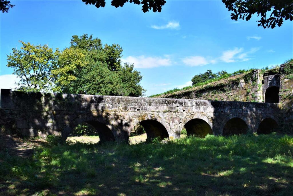
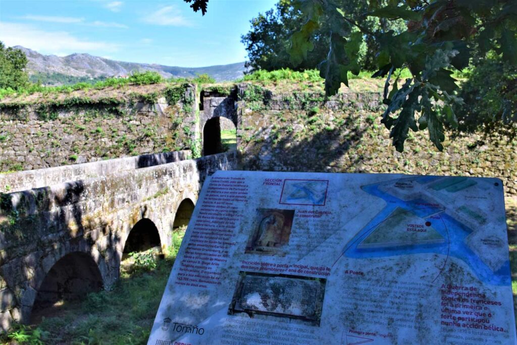
The moat is crossed by a beautiful six-arch bridge that gives access to the main gate. On the sides of this door are the coats of arms corresponding to the surnames Giron and Castillo. Between the two shields is an inscription:
“This fort was built under the reign of Carlos II, king of Spain and the Queen Governor, his mother, Lady Mariana e Austria, while the governor and general captain of this kingdom, the former archbishop of Santiago his excellency Lord Andrés Giron, who was assisted by the illustrious Lord Juan de Castillo, Mº of Cº General of the Council of Gº of his MGD, year 1673”.
This Galician border system consists of the forts of “Nosa Señora de la Concepción” (Our lady of Conception), As Chagas, San Lourenzo fortress and the Correa Towers in Goián, and also the Santiago Carrillo de Medos fortress in Éstas. In the Portuguese side, it is made up of the Plaza-Fort and medieval enclosure of Vilanova de Cerveira, the Espiritu Santo Watchtower (Holly Spirit Watchtower) and the Lovelhe fortress.
To know it better
Tomiño is a Galician municipality in the province of Pontevedra. It is located on the Miño river´s banks, right in front of Portugal.
Goián is one of the parishes of Tomiño and the second urban centre of the municipality. In this city centre, we can find the painter´s square of “Antonio Fernández”, where we can see an 18th century parish church, the rector´s house or the parish priest´s house and the main artery.
The Vilanova de Cerveira - Goián border system is located in Goián, where the military wall and castle stand out. The purpose of this construction was to protect the village against conflicts with Portugal after the Restoration War ended in 1668.
It is a system that pits the population of the two countries against each other. Furthermore, thanks to its location, the river border could be controlled
Gallery
Location
- Locality
- Goián
- Municipality
- Tomiño
- Province
- Pontevedra
- Country
- Spain
The asset
- Type
- Fortress
- Eco-destination
- Río Miño
- Environment
- Rural
- Relevance
- National
How to get there
- Access
- By sea By land
- Distance
- 0.000km
The visit
- Visitable
- Yes
- Accessible
- Sí
- Parking
- Sí
- Signposted
- Yes
Coordinates
- Latitud
- 41.94097700
- Longitud
- -8.75410300