
Oia. Roman salt mine. Mougás
About this heritage
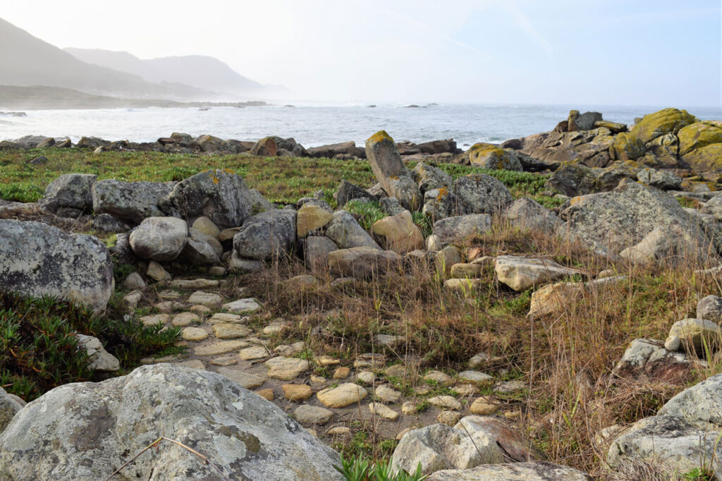
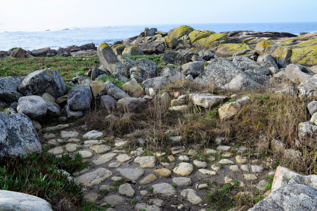
Oia has vestiges of the Roman era. This is a salt mine located in the Burqueira parish, and the salt mines located on the Mougás and Viladesuso coasts. They are facilities in which the salt was produced, possibly for fish-salting, an industry that already in Roman times had a great importance in the area, as evidenced by the other salt mines existence such as the ones in A Guarda or Vigo, to name a few.
Oia currently has a population of 3.000 inhabitants and a 18km long coast. Its economy is based on services, agriculture, fishing and construction. Among the six parishes that form it, Santa Eugenia de Mougás has some interesting petroglyphs called “Petroglifos da Cabeciña”, and the Castro da Cabeciña (traditional Galician fortress). The church is also of interest, “Santa Urxía de Mougás”, with a Romanesque style it is dated from 1137 although no remains are preserved, the actual church was built in 1698 and it was renovated by the master Xose Areal in 1840.
If you want to visit the “Pía de sacrificios de Mougás” (An old altar for ritual sacrifices) it is necessary to go to the Provincial Museum of Pontevedra.
Mougás is also a destination on the first stage of the Coastal Way of Saint James. This way departs from the Miño river´s mouth, then it goes along the Atlantic coast until it arrives to Redondela, where it links to the Portuguese way.
To learn more
The coastal route from A Guardia to Redondela, which passes through Oia, offers impressive landscapes. As we have already commented, Mougas is both, stage end and beginning of the Coastal Way. From the second stage Mougás – A Ramallosa, Mougás port and rocky areas stand out. A few kilometres away we can also find the archaeological complex of “A Cabeciña”, formed by petroglyphs and a Castro (Old Galician fortress) with defensive structures. At this point, to stop to contemplate the views offered by the Atlantic is completely worth it.
To get to the Roman salt mines in Oia, it is necessary to go to Mougás. It is believed that it was an industrial exploitation and not for self-consumption, due to the site´s big size.
Changing the topic, Oia´s City Council is located in “Serra da Groba”, this circumstances makes the landscaping variety of great contrast, as the mountain landscape coexists with the coastal one. The traveller can visit the Fervenza river and the puddles from Mougás or Lourenza, also the leisure area “Pozo do Arco” next to the Tamuxe river.
“Sobreiras do Faro” beauty is worth mentioning, it is the most occidental Mediterranean forest from Europe, is located in Viladesuso and it is the first Galician Private Space of Natural Interest, forming part of the “Árbores Senlleiras de Galicia” Catalogue (catalogue of singular trees, with a special value).
As for the fauna, Oia has in the horse its most emblematic animal, has been living freely in Serra da Groba for ages. In Oia, “Curros” (Galician traditional ranching events) in Valga, Torroña and Mougás were celebrated.
To know it better
Oia is located between Baiona and A Guardia, in the province of Pontevedra. In this city, a monastery with a big church near the sea was built many years ago, it was dedicated to Holy Mary and it became the principal monument of the City Council.
Recently, in 2017, industrial salt mines were found in Oia´s municipality. The archaeological action and different excavations are being carried out in the parishes of Viladesuso and Mougás thanks to the warning from two neighbours.
Salt mines were places widely used in old times, where they left the salt water to be evaporated so they could dry it and collect it. With this procedure, salt was obtained for the latter sale. Phoenicians were the first to build sea salt mines and, later, they were used by the Romans.
Galería
Location
- Locality
- Mougas ( Santa Uxia)
- Municipality
- Oia
- Province
- Pontevedra
- Country
- Spain
The asset
- Type
- Salt flats
- Eco-destination
- Ría de Vigo
- Environment
- Rural
- Relevance
- National
How to get there
- Access
- By sea By land
- Distance
- 9.900km
The visit
- Accessible
- No
- Parking
- No
Coordinates
- Latitud
- 42.05093629
- Longitud
- -8.88654448