


Ribadumia Ancient Fortification
About this heritage
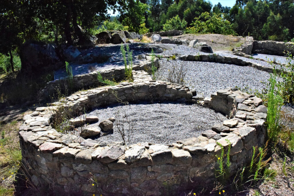
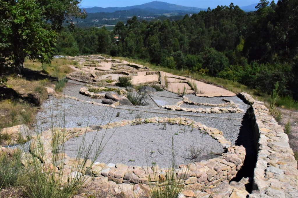
The archaeological site of Mount O Castro, in Ribadumia, is a fortified Iron Age settlement located at an altitude of 110 metres. It is located on an embankment with an extended view of the last valley on the river Umia. Judging by its documented remains, it is believed that it could have been inhabited during the 4th century B.C., and 1st century A.D. During the excavations carried out in 2011, thirteen huts, a large patio house and a wall were discovered, as well as thousands of items, which indicate the intense trade that this settlement maintained with ancient civilizations, such as the Phoenicians.
To learn more
The Ribadumia site is a perfect example of the stone extraction and mountain’s exploitation; an indication of this are the old quarries that still exist, both in its surrounding area, as within its periphery. The fortification is of average dimensions, inasmuch as with respect to the typical settlements of the Iron Age, which had a dense occupation from the 4th century B.C. through to the 1st century A.D., when it was destroyed by the rage of fire and abandoned.
One structure that stands out from the rest, is a large courtyard house, designed like those documented at the San Cibráo de Lás fortification in Ourense, and other fortifications in the south of Galicia and north of Portugal. The living quarters extend all around the courtyard, and different structures, carried out in various materials, were developed throughout the history of the fortification. The first constructions were built with perishable materials, which were later replaced by stone structures and the circular dwellings from the 2nd century B.C., were converted into storage spaces, again, constructed with perishable materials.
Amongst the thousands of items found during the archaeological campaigns were the ceramics dating between the 5th century B.C. to the 1st century A.D, originating from North Africa and area of Gadir (present-day Cadiz), as well as a fragment of a Rhodian aryballos. An aryballos is a Greek vase with a globular shape and a short, narrow neck that was used to contain perfumed oil, used in body care.
For centuries, the Phoenicians, Romans, Saracens and Vikings came to the region of O Salnés in the Rías Baixas, drawn by the region’s wealth. It is still possible today to trace the steps of their travels through the region, in the surroundings of the Arousa estuary, an area scattered with fortifications, which serve as witness to the extensive history of the area.
The Phoenicians would choose the islands to carry out their commercial transactions with the inhabitants of the places they visited. One of the reasons was the security these provided.
The Phoenicians were outstanding navigators and merchants. Their specialisation in certain manufactures enabled them to engage in highly profitable trade with neighbouring kingdoms and overseas. The Phoenicians provided cedar wood, fabrics (including the famous purple ones), carved ivory, furniture made of hard wood, pendants, bowls and jars made of gold and silver, and in general, valuable handcrafts. Besides this, they exchanged silver, lead and tin that they obtained in Spain, wheat and linen from Egypt, balsams and honey from Israel, horses and mules from Anatolia, ivory and slaves from Africa, oil and cereals from Greece.
Metals were their primary target on the Atlantic route. They were the maritime transmitters of the new metal, revolutionary both in war and in the countryside: iron, which was used for the first time in the Hittite country. The Phoenicians also went in search of tin, an indispensable material for making bronze by alloying it with copper, reaching the Cassiterides Islands.
Tin could be found only 30 kilometers off the Galician coast. In addition, the area of the Rías Baixas had a fluvial route, the river Miño, to enter the interior, and the estuaries had extraordinary natural ports to be able to anchor and trade with the indigenous communities. According to Herodotus, the Phoenicians lit bonfires on the beaches and left the goods there to exchange their products. It is difficult to know if this is the case, although Punic and Neopunic ceramics from the 6th to 1st centuries BC have been found on the fossil beaches of O Arenal in Vigo.
Trade between the Phoenicians and the peninsular northwest intensified after the First Punic War (264-241 B.C.). The loss of some Mediterranean territories and the Roman irruption as a new power, forced the Phoenician merchants to look for other destinations where they could obtain raw materials in exchange for their products. It was in this search that the mercantile routes were established bringing to the northwest an abundant number of materials and objects of Mediterranean origin.
To know it better
The Besomaño, Leiro or Ribadumia castrum (ancient fortification) is located on a hill in Ribadumia (Pontevedra), of important archaeological importance. The fortification is located on the Monte do Castro and is one of the Gallaecian fortifications where rehabilitation work was carried out on the dwellings, to assist getting a notion of the site.
The Monte do Castro was occupied and re-occupied from the 4th century B.C., up until the 1st century A.D. The inhabitants of this castrum developed the castro culture, characterized by the peculiar manner in which they organized their subsistence. In this settlement, there is a predominance of circular stone constructions, although there are also oval and square ones. The castrum was subsequently destroyed by fire and eventually abandoned.
The area was subjected to stone extraction, perhaps since the beginning of the settlement until way into the 20th century. Furthermore, and thanks to archaeological researchers, 140,000 items were collected, amongst others, ceramics ranging from the 5th century B.C., through to the 1st century B.C.
Gallery
Location
- Town
- Besomaño
- Municipality
- Ribadumia
- Province
- Pontevedra
- Country
- Spain
The asset
- Type
- Castro
- Eco-destination
- Ría de Arousa
- Environment
- Rural
- Relevance
- International
How to get there
- Access
- By land
- Distance
- Distancia 7,9 km / 14 minutos en coche
The visit
- Accessible
- No
- Parking
- No
Coordinates
- Latitud
- 42.52382600
- Longitud
- -8.73954200