


Cortegada Island. Village. Chapel and surroundings. Punta Corveiro stone cross (cruceiro). Esteiro de Ulla Views.
About this heritage
In Galicia there is an island where a forest smells like laurel and seafood, its sand banks provide the clams, cockles or razor clams; and the land, the necessary laurel to aromatize such tasty sea products. It is the Cortegada island, called Corticata by the Romans, the first settlement to colonize the islet, from which documentation and historical vestiges are obtained. It has centenary trees hide meadows and lands that were cultivated in another time, an hermitage and a stone cross (cruceiro) that contemplates the Ulla river´s mouth. Its dense laurel forest is the largest in Europe.
The natural value of this land located in the interior of the Arousa estuary, is conditioned by specific climatic conditions, more typical of southern locations than the Atlantic. They favour humidity and the development of an understory with unique species of fungi, a mycologist´s paradise. With two own water sources that emanate of their lands, the coastal perimeter, is bathed by the Ulla estuary.
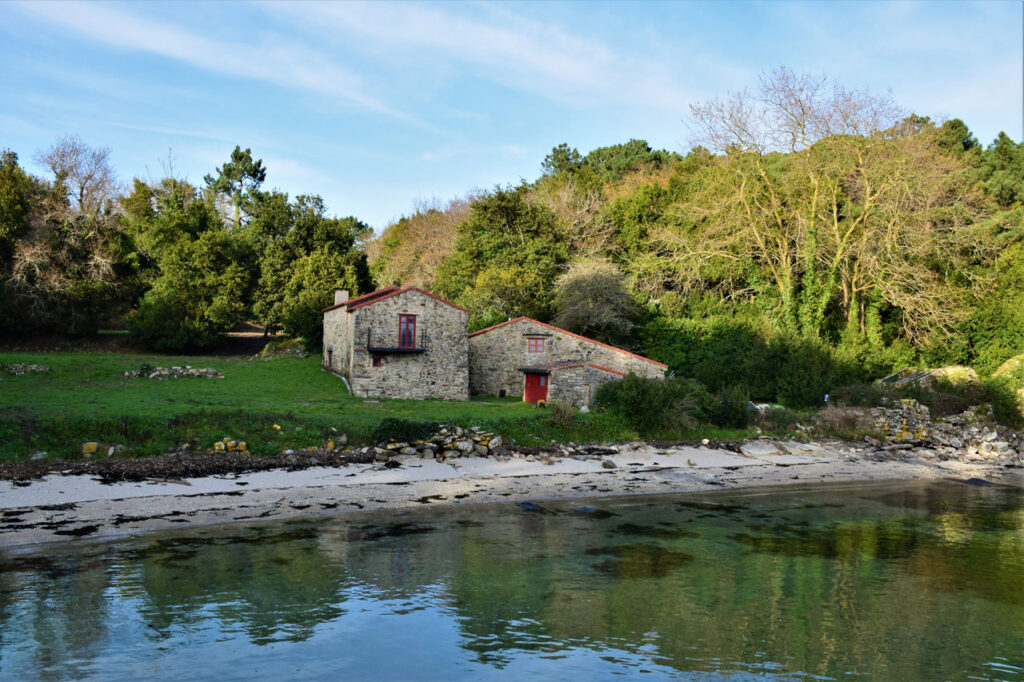
In Cortegada we can contemplate the chapel and the Stone cross (cruceiro). If we turn to the left, we rise in a small “Outeiro”, a place that receives the name of “A Torre” (The Tower), so it would not be strange that there had been a small fortress. Its stone cross stands in front of the Cortegada´s old monastery, next to the island´s coastline. It is one of the largest, forming an archipelago with other islands such as Malveiras or Briñas. At low tide the old “Camiño do Carro” (Car´s way) emerges from the water, a footpath that provides access to the island, once used to transport cargo.
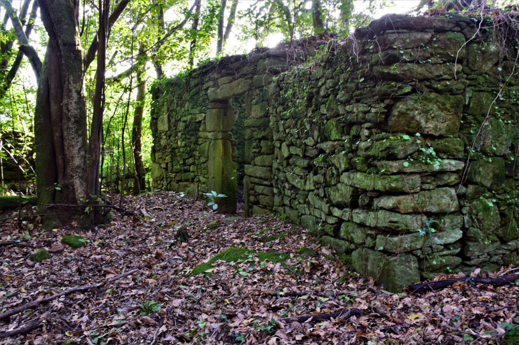
Until the 20th century it was inhabited by settlers who tilled their land and paid rents to the Pazo of Golpelleira (Old traditional manor house). There are still remains of their houses among the leafy vegetation, a 19th century mansion, stables, wells and a hospital built in the 17th century, reused as a lazaretto.
To learn more
The natural value has not been the predominant one in the development of the island of Cortegada, it is worth mentioning the important cultural and historical value that, defined its style and in what has become today. Its first documented inhabitants were the Romans who called the island Corticata, from which it receives its current designation. Mentioned in the first century by Pliny in this way, history has passed through it leaving a multitude of tracks. The romans left vases in their immediate vicinity which allowed to date their stay as stated in various documents, in the middle ages a monastery occupied some land where now only a church and a traditional stone cross (cruceiro) remain.
In the high middle ages the Normans were installed, as well as the Muslims, with the ultimate aim of a attacking Compostela. This island became a strategic point of resting and provisioning to secure their ship and not jeopardize the return back home with the cargo of treasures from Compostela. The choice of this camp was not random; a few kilometres away was the “Castellum Honesti of Catoria” which, with the West Towers, was the most important fortress of the whole Arousa defensive system; defence of the Galicia capital.
Later, in the 14th century, the “Virgen de los Milagros” (Virgin of Miracles) hermitage was built entrusted to rid the inhabitants of the black plague (Black Death) that devastated Galicia. For this reason, we find a hospital-lazaretto dating from the end of the 16th century very close to the ports of Carril and Vilagarcía. The hermitage of “Nosa Señora de Cortegada” (Our Lady of Cortegada) it´s today in ruins, still maintaining the coat of arms of the archbishop of Santiago, Fernando de Andrade and Soutomaior, and crowning the main door.
Together with the religious occupation, and thanks to the fresh water that was born in the island, a village was established of which the walls of many houses are still standing, as well as presses, millstones or some Hórreo´s feet (Old raised granaries). The inhabitants of the Cortegada island had among their economic activities fishing, shellfishing, agriculture and livestock. That is why the landscape of the island at that time, until the moment of its abandonment, was far away from what we can contemplate today.
The scarce trees and smallholdings dominated the island until the beginning of the 20th century, the idea of building a Royal Palace on the Galician coast in competition with other cities on the peninsula began to be launched not in an altruistic way. The intention was to turn Vilagarcía into a great spa-city, which is why the donation of Cortegada island to the monarchy for its summer residence is seriously considered. The donation that was made in 1907 in the name of Alfonso XIII, caused his neighbours had to abandon it to finally fall the urban plan of the crown, as the king had built the palace of the Magdalena in Santander. The people were left without their lands and the monarch took over an islet that he hardly ever used as a hunting ground.
The island returned to public domain during the II Republic, returning again to the royal family during the Franco regime. Juan de Borbón later sold it to a real estate agency with the intention of building a bridge, hotels, chalets and even an auditorium, plans truncated by the coastal law and the social pressure exerted by its neighbours, swindled. In 2007, it was acquired by the Xunta de Galicia (Government of Galicia), becoming again public domain.
With an area of 191 hectares (43.8 terrestrial and 147.2 marine) has several beaches, one of them a little bit small when the tide rises. The two Malveira islands, “Grande”(Big) and “Pequena” (small), which house the first cross of the Via Crucis fluvial Xacobeo that extends to Padrón, are lost sight of. By the way, unique in the world.
At 900 meters from the exit, the visitor is in the middle of Europe´s highest laurel forest. The next point of interest is the second cruceiro (traditional stone cross). With Carril in front of us, we can reach the largest sandy-area of the island, to enter a wooded area in which it is recommend to never leave the path. Before your eyes, the abandoned, ghostly, unreal village. And leaving it behind, what is left of the Hórreos (old raised granaries) and warehouses. As a reference, a wharf from which they departed towards the coast, crossing the estuary of the Ulla river ad seeing on one side Carril and on the other Vilagarcía.
To know it better
Cortegada is a Galician island located in the Pontevedra province. The Cortegada archipelago is made up of this island and another group of island, the Malveiras islands and the Briñas islands. Cortegada is the biggest of them. In its forest, laurel and seafood stand out. In fact, the shellfish catchers of the Arousa estuary take advantage of their location to collect these products.
Two circular routes can be made on the island from the ruins of the “Virgen de los Milagros” hermitage, dating from 1652. After that, a hospital-lazaretto was built near the chapel for the numerous pilgrims who made petitions to the Virgin. In addition, there are the remains of an old village, which was inhabited until the donation of the island to King Alfonso XIII, in 1910.
The Deza river is one of the largest tributaries of the Ulla river and both rivers serve to limit the provinces of A Coruña and Pontevedra. The final stretch of the Ulla river forms a wide inlet with areas of marshland and grove that offers spectacular views of the landscape.
Gallery
Location
- Town
- Natural
- Municipality
- Vilagarcía de Arousa
- Province
- Pontevedra
- Country
- Spain
The asset
- Type
- Island
- Eco-destination
- Ría de Arousa
- Environment
- Natural
- Relevance
- International
How to get there
- Access
- By sea By land
- Distance
- 0 km
The visit
- Visitable
- By private boat:It can be visited all year round but it is necessary to have the navigation permit and the anchoring permit issued by the Park.Access on foot: Yes
- Accessible
- No
- Parking
- No
- Website
- isladecortegada.com/
Coordinates
- Latitud
- 42.61796700
- Longitud
- -8.78527100