
Caaveiro Monastery
About this heritage
The Monastery of Caaveiro is in the Fragas (Woodland) of Eume, a Natural Park with the best Atlantic coastal forest in Europe.
It lies an enormous mound protruding from the low valley of the Eume River. Although the monastery had existed for years, Saint Rudesind founded it as a Benedictine one in 936. Later in 1135, it was Alfonso VII and his wife Berenguela who reopened it again.
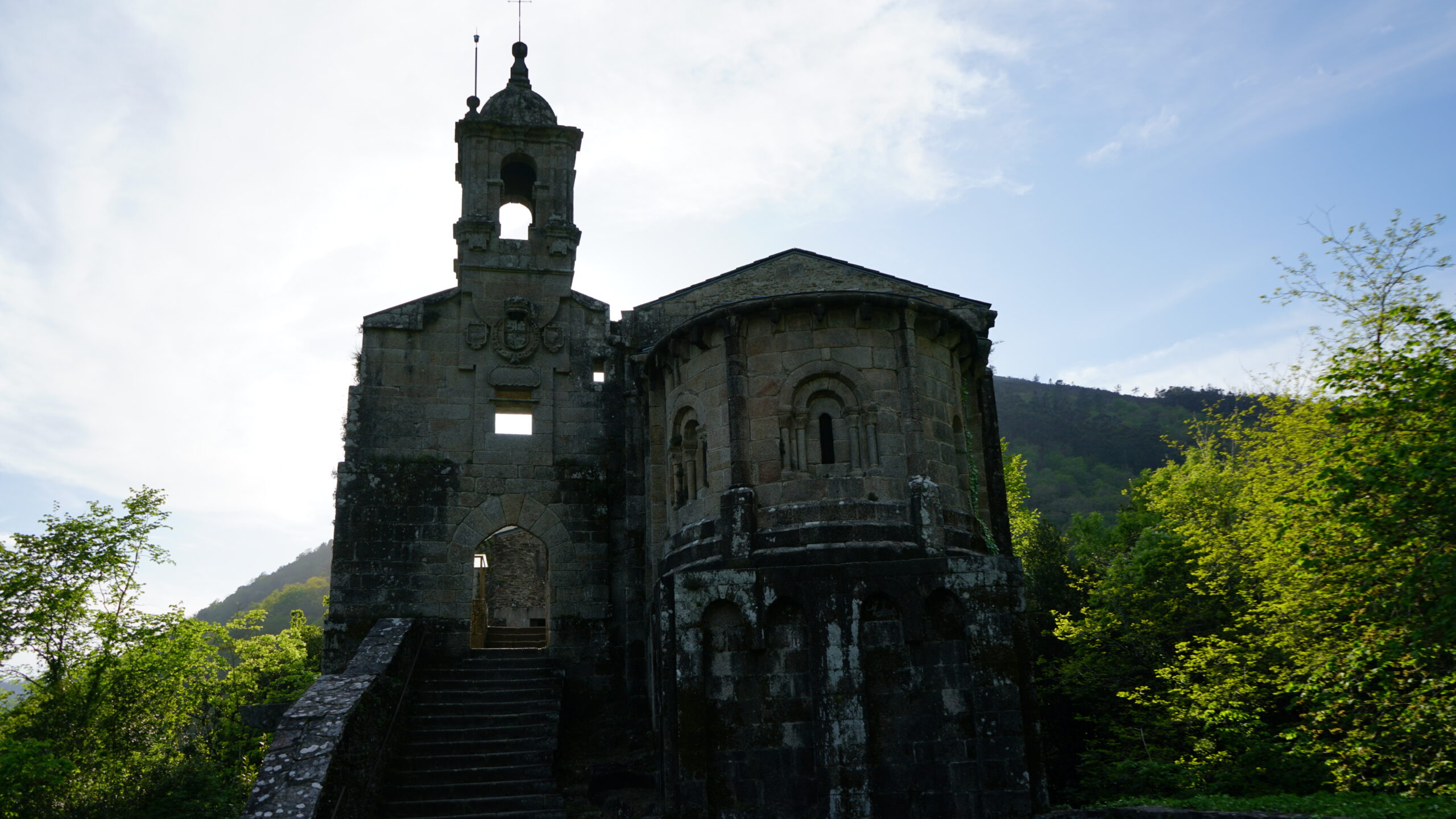
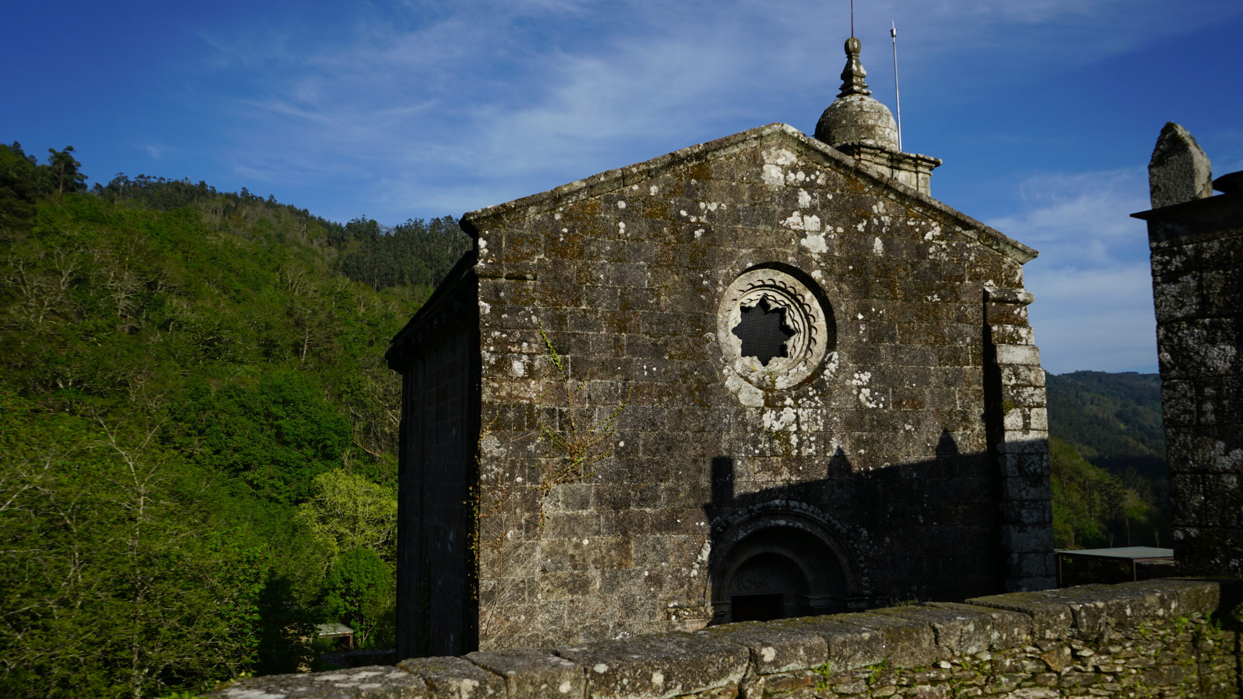
It is believed that there were two churches; however, only a Romanesque-style church exists today. It has a small rectangular nave, from the end of the 12th century, with a disproportionally large apse composed of a straight section and a semicircular one and preceded by a triumphal semicircular arch slightly cambered on semi-columns. The apse is covered by a barrel vault followed by a quarter-sphere vault with arrowslits, which from the exterior become multi-semicircular arches on two pairs of angled columns.
From A Capela's Town Hall, one can reach the monastery by choosing one of the few access roads. The friars that habilitated the Caaveiro and part of the place called "O Pousadoiro" (the Inn or Lodge) used the oldest road, called the medieval road.
To learn more
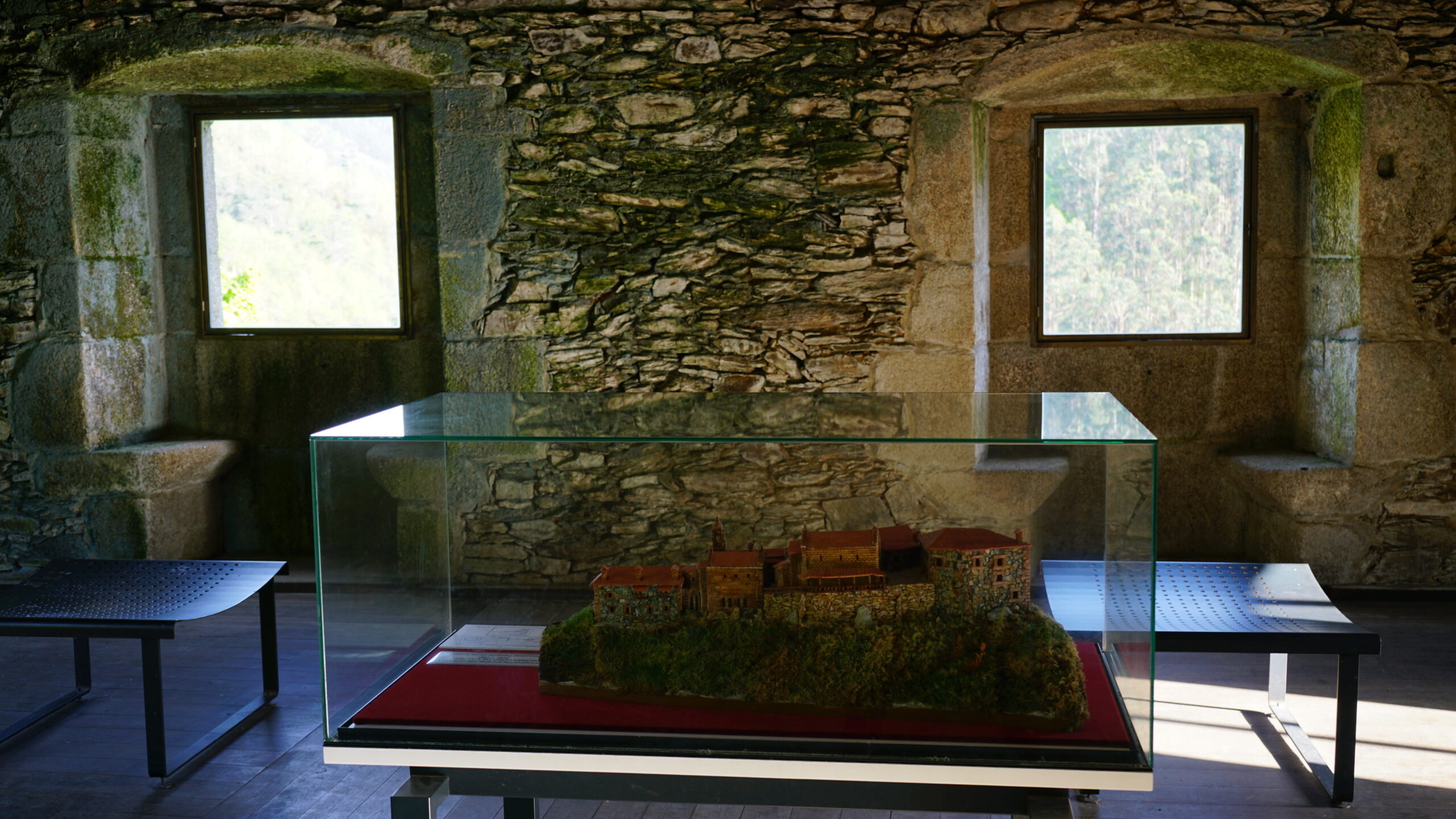
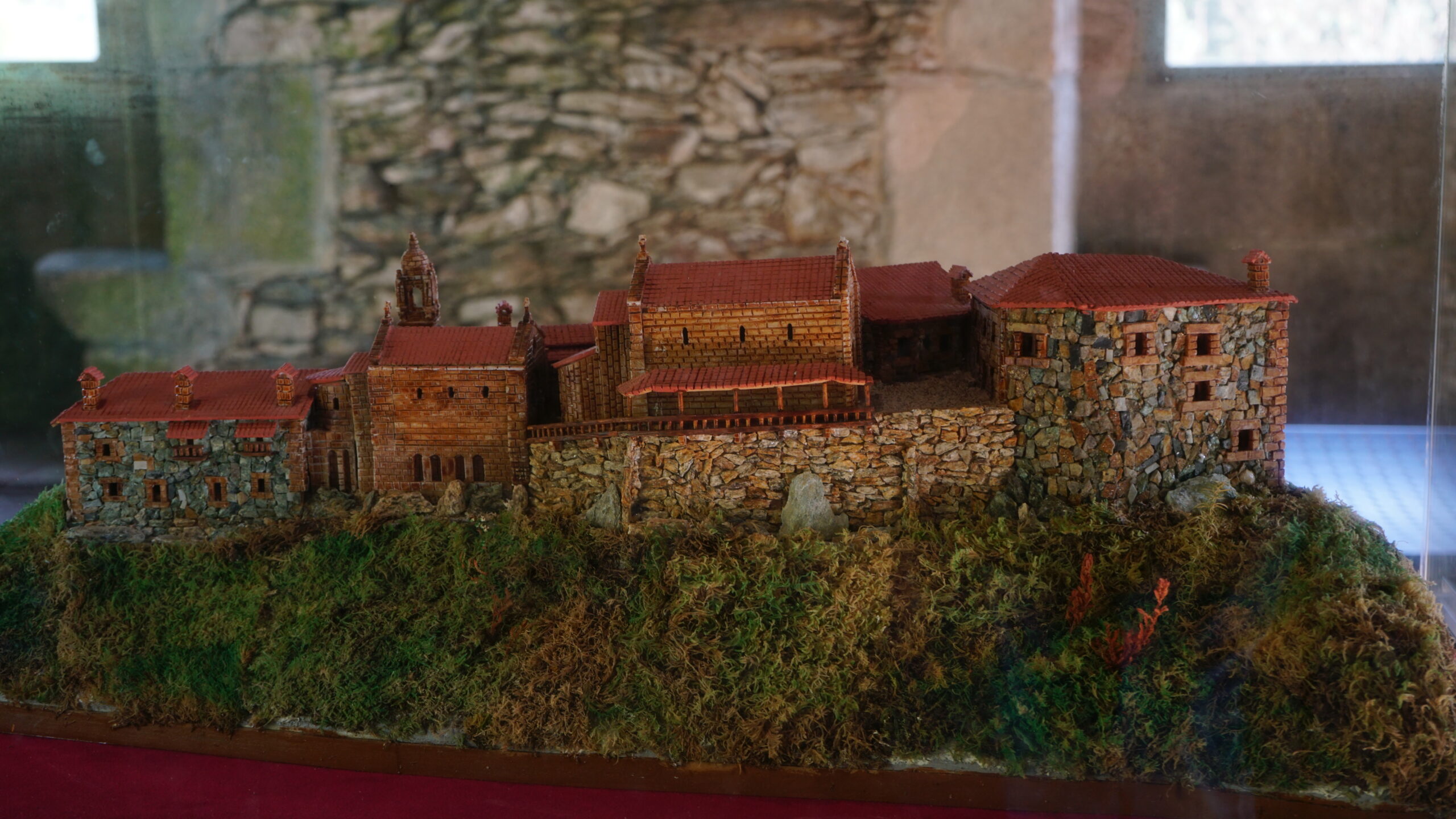
The monastery of Caaveiro is in the middle of the Woodland (Fragas) of Eume, and followed the rules of the Order of Saint Benedict. Later was a monastery of the "the Canons Regular of Saint Augustine," a catholic religious order of a community dedicated to observing the regular life and combined it with the clerical status and the apostolic life. Like other monasteries, this one is a group of buildings, such as the main church, the Church of Santa Isabel, cells, chapter house, sacristy, well, storerooms, archives, and bell tower. Currently, some have already disappeared.
Although the monastery had existed for years, Saint Rudesind founded it as a Benedictine one in 936. Later in 1135, it was Alfonso VII and his wife Berenguela who reopened it again. However, the information came from tradition until April 1154, that a papal document reference the monastery in writing, becoming the first reliable source. Probably on the second half of the 13th century, the monastery transferred into the hands of the "the Canons Regular of Saint Augustine," putting an end to the monastic life at the end of the same century. With the Mendizábal’s Law of Disentailment in 1836, the monastery's assets disappeared, passing into private hands, including the Saint Rudesind's relics, transferred to Santiago de Compostela.
The present church is Romanesque, from the end of the 13th century. The floor plans allow us to appreciate its small rectangular nave with a disproportionally large apse composed of a straight section and a semicircular one, preceded by a triumphal semicircular arch slightly cambered on semi-columns. The apse is covered by a barrel vault followed by a quarter-sphere vault with arrowslits, which from the exterior become multi-semicircular arches on two pairs of angled columns.
The outside is remarkable for its location since it is on a summit. The access has an elongated-shaped area, and the monastery's entrance has a staircase that reaches the entrance arch, over which rises the baroque bell tower, with seventeenth-century bells; thus, giving a sense of being even more enlarged. The Church's Romanesque apse is on the right, enhancing the sense of size because sits on a base, and therefore, saving the unevenness. Original Romanesque essence prevails since elements, such as the attached columns, the windows with sculpted moldings, the corbels' cornices, are intact and all decorated with arcades of double components.
The façade is formed by double semicircular moldings on two pairs of columns framing a tympanum with the Agnus Dei figure, signifying Jesus Christ as a victim offered in sacrifice for the sins of men, which resembles the lamb sacrificed and consumed by the Jews in the Passover celebration.
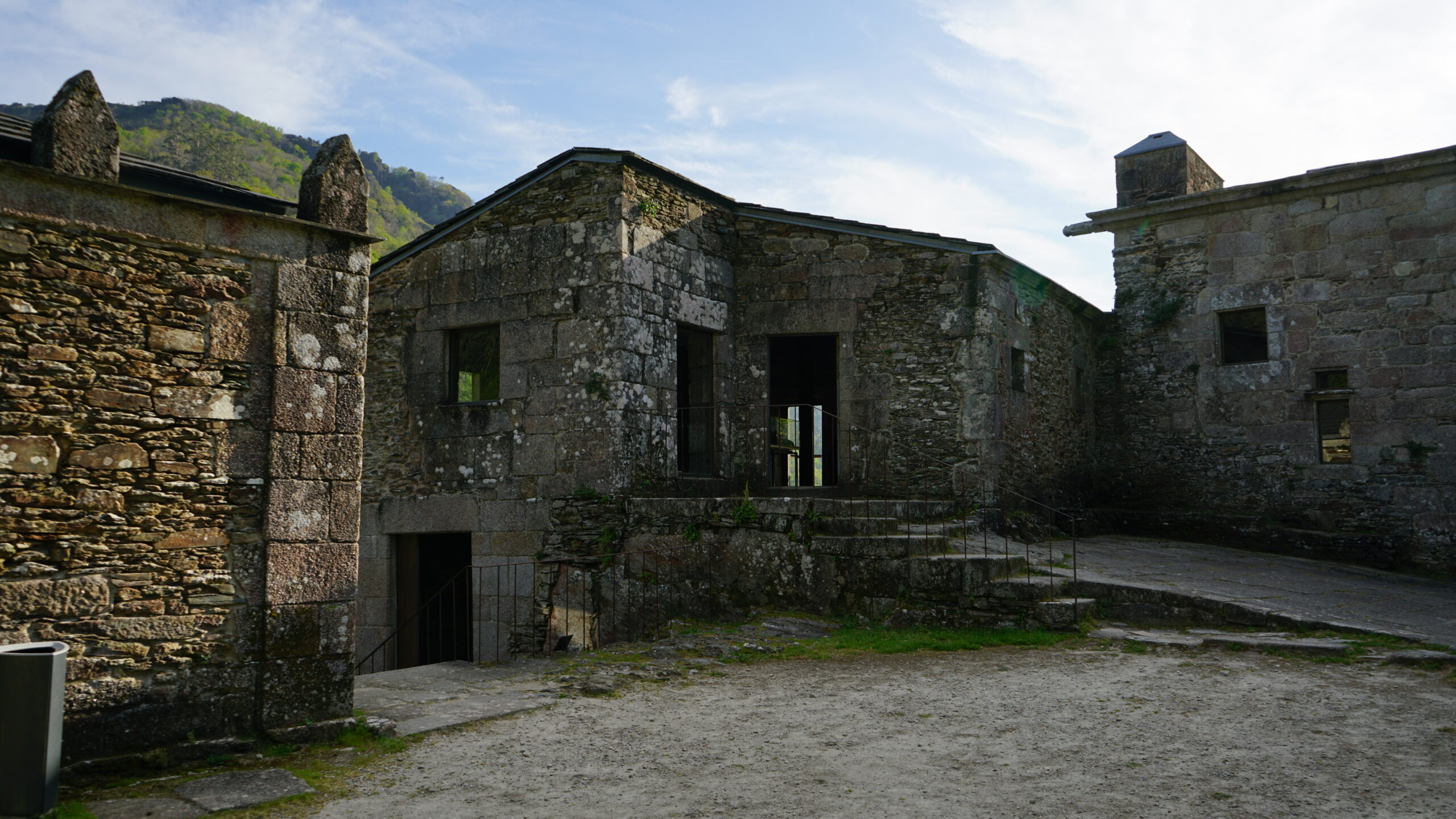
The remains of several constructions within the enclosure complete the complex, such as the sacristy or dwellings like the Casa de Quintás.
To know it better
A Capela is a Galician municipality located in the province of A Coruña, where the Caaveiro monastery is located. The municipality is made up of the parishes of Caaveiro, Cabalar, and A Capela.
The Eume River flows through this town to, subsequently, enter into the Atlantic Ocean. Therefore, according to history, Pontedeume receives its name for being the municipality that gave birth to this river.
About fourteen kilometers from Pontedeume, we find the Monastery of Saint John (Xoán) of Caaveiro or simply Caaveiro. It is on a rocky mound between the Eume and Sesín Rivers, in the Woodland (Fraga) of Eume, making this secluded monastery even more spectacular. Its origins date back to the 10th century and, according to legend, Saint Rudesind founded it to gather a group of anchorites (intensely prayer-orientated and ascetic religious people that live in secluded places).
Alfonso VII gave a notable impulse to the convent in 1135, and over the centuries, this one gained significance thanks to Alfonso III, Fernando II, and Alfonso IX contributions until it reached the level of the collegiate church in the 17th century.
The architectural ensemble formed by the central church, the church of Santa Isabel, the cells, the chapter, the sacristy, a well, storerooms, the archive, bell tower, among others, was declared of Cultural Interest in 1975. The present church is Romanesque from the end of the 12th century and consists of a small rectangular nave with an apse covered with a barrel vault followed by a quarter-sphere one.
Galería
Location
- Locality
- A Capela
- Municipality
- Pontedeume
- Province
- A Coruña
- Country
- Spain
The asset
- Type
- Monastery
- Eco-destination
- Rías de Ares y Betanzos
- Environment
- Natural
- Relevance
- National
How to get there
- Access
- By sea
- Distance
- 13,200 km
The visit
- Visitable
- Yes
- Interpretation
- Yes
- Accessible
- No
- Parking
- No
- Signposted
- Yes
Coordinates
- Latitud
- 43.417641202528976
- Longitud
- -8.068522529706009