
Ons island. General Flora and General Park
About this heritage
Ons island is an archipelago that belongs to the Maritime-Terrestrial National Park of the Atlantic Islands of Galicia (PNMTIAG). It is formed by two larger islands that would correspond to Ons and Ounce (or Onceta), and the Freitosas islet.
It belongs to the Bueu city council. Its surface area of 2,641 hectares - of which 470 ha are on land and 2,171 ha are at sea - gives clear evidence that this National Park is representative of the coastal marine ecosystems of the Atlantic Ocean.
It has other protection figures such as Special Protection Area for Birds (ZEPA) and Special Conservation Area (ZEC) “Ons-O Grove Complex".
Ons island can be visited, while the others that make up the archipelago are a reserve area. There are four main circular routes that run through the island.
The archipelago has a smooth and flat profile, large expanses of gorse predominate with isolated formations of eucalyptus, acacia, pine, and small willow´s patches in more sheltered areas with greater soil thickness.
Its cliffs have cushioned formations of sea thrift Armeria pubigera and due to the colonies of birds that live on the island they have a greater contribution of nutrients and a greater diversity of cliff flora is found such as the sea mayweed Matricaria maritima subsp. Maritima.
The island´s vegetation is very conditioned by the winds, high salinity, seasonal aridity and the scarce development of the soil. The coastal scrub ecosystem predominates on the island, located at the top of the cliff, the waist least influenced by the splashes.
In Ons there are humid hydrophilic heaths, which grow in deeper and wetter soils. The most important are the heather Erica ciliaris and the thistle Cirsium filipendulum and above all the gorse Ulex europaeus subsp. Latebracteaus.
Another type of bush vegetation is made up of the broom (abundant in Ons) and there is one in particular, endemic exclusively to the National Park, the broom Cytisus insularis.
The formations of blackthorn Prunus spinosa are curious, which correspond to previous stages to the natural tree vegetation, and could be considered as indigenous spiny communities of forest edge.
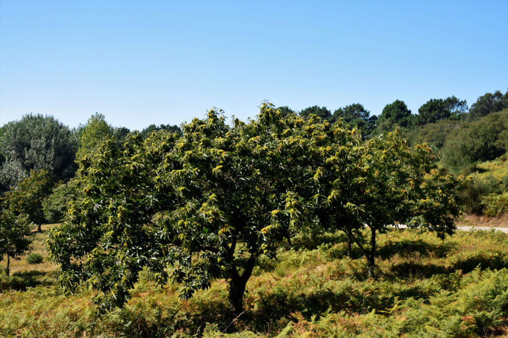
The main traces of native forest in Ons are Salix atrocinerea willows that form small patches, some Pyrenean oak in the northern part Quercus pyrenaica and also grow elders Sambucus nigra, Castanea sativa sweet chesnut or Laurus nobilis laurels.
The beaches and dunes are also habitats that withstand high sunshine, dryness and salinity. This substrate is very poor in nutrients and due to the winds and the lightness of the sand they suffer movements and changes. Dune plants have adaptations in order to survive these conditions.
The closest community to the beach is characterized by a plant association in which the European sea-rocket Cakile maritimum stands out, accompanied by sea sandwort Honkenya peploides and Polygonum maritimum, among others.
The first dune front or primary dunes are the closest to the coast, in an area very exposed to the marine dynamics. It is there that the sand couch grass Elytrigia juncea subsp. boreali-atlanticus, which, with its long roots, is able to fix itself to the substrate and withstand both the effect of the waves during the live tides and the wind and thus, fix sand behind it. It is accompanied by other species such as the sea holly Eryngium maritimun or the morning glory Calystegia soldanella.
The secondary dunes form the second chain of dunes, which is more protected than the first one, and there are species such as the European marram-grass Ammophila arenaria which colonises the dune crests thanks to its roots which are up to 4 metres deep, and other species such as the cotton weed plant Otanthus maritimus, the morning glory and the sea spurge Euphorbia paralias.
To learn more
The Ons archipelago is located in the Euro-Siberian Region, Atlantic Super-province, Atlantic-European Province and within the Galician-Portuguese Sector it occupies the Miñense (reference to the Miño river) Subsector, the latter indicating a markedly Mediterranean climate, with a greater summer drought than the other areas.
The vegetation that lives close to the sea has to withstand difficulties such as the high salinity of this environment, strong winds, splashes from the waves, very porous soils with low water and nutrient retention capacity, strong sunshine due to the reflection of the sand, mobility of the sandy substrate, and so on.
Plants can survive because they have adaptations like with the wind with their cushioned growth. They are rounded plant formations that are stuck to the ground to resist the winds like the subspecies of gorse found on the island Ulex europaeus subsp. Latebracteaus or the sea thrift that grow on the cliffs Armeria pubigera.
There are also adaptations to heat stroke with the development of whitish colours, hairs, wax coatings or thickened cuticles. In this way they reflect the light and is not directly affected by it. The cotton weed plant Otanthus maritimus is a dune plant covered entirely with hair.
Drought is another limiting factor so, beaches and dunes develop long roots to catch water, like the European marram grass Ammophila arenaria subsp. Australis or water storage structures, such as bulbs or tubers of the sea daffodil Pancratium maritimum or the thickened leaves of the European sea-rocket Cakile maritimum. And to avoid water loss they develop mechanisms that reduce transpiration such as reduction of leaf surface, hard and sharp leaves or protective waxes.
In addition to the problems already mentioned, life in the sand presents other difficulties. It is a mobile substrate that moves with the wind, exposes roots or buries plants, which otherwise would suffer from a lack of nutrients.
Tissue strengthening, long root development, decreased leaf size or association with nitrogen-fixing bacteria are some of the adaptations to counteract these effects. They are seen in plants such as toadflax polygalifolia subsp. polygalifolia or the curry plant Helichrysum italicum subsp. Serotinum.
The proximity to the sea produces a high salinity, here grow halophilic plants specialized in these media that have a fleshy appearance because they accumulate salts and water in their cells to compensate the concentrations with the outside and facilitate the absorption of water, also the reduction of the leaf area as the Salicornia perennis and Salicornia ramisissima.
To know it better
The Parque Nacional das Illas Atlánticas de Galicia is made up of the archipelagos of Cíes, Ons, Sálvora and Cortegada and the maritime waters of their natural surroundings. Ons is located in front of the Pontevedra estuary -in the province of the same name- and it is formed by two islands: Ons, bigger and still populated, and Onza, the smaller one.
One of the main attractions of the island is its spectacular natural environment. People who come to this place will be able to enjoy different routes that will take them to discover its beaches, landscapes and its cliffs. The flora of the island is composed, in its great majority, of bushes with ferns, heathers, sloes, broom, and gorse. Tree species are reduced to willows and alders, although eucalyptus, pines and oaks can be found in some areas. It also has a species of woody plant almost 2 meters high known as “xesta"; or broom that accompanies the “tojos" (gorse); on the cliffs. The “Xesta de Ons” is currently in danger of extinction, as it can only be seen on this island or in Sálvora island.
Galería
Location
- Locality
- Bueu
- Municipality
- Bueu
- Province
- Pontevedra
- Country
- Spain
The asset
- Type
- Island
- Eco-destination
- Ría de Pontevedra
- Environment
- Natural
- Relevance
- International
How to get there
- Access
- By sea By land
- Distance
- 0 km
The visit
- Visitable
- It can be visited all year round, previously they must have the authorization of the Xunta de Galicia to visit the natural park.
- Interpretation
- At the end of the access dock there is an information panel with a map of the archipelago,with services, points of interest and itineraries. A map and route catalog of the Natural Park can be downloaded from the website of the Islas Atlánticas National
- Accessible
- No
- Parking
- No
Coordinates
- Latitud
- 42.37720200
- Longitud
- -8.93143100