
Phoenician Wharf of A Covasa

About this heritage
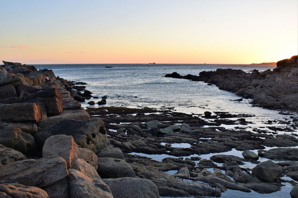
Located in the parish of Aguiño, in one of the westernmost points of the peninsula of O Barbanza, is the Phoenician wharf of A Covasa, a unique structure in Galicia. The wharf was built by the Phoenician navigators and used as a stopover point, during their commercial visits along the Galician coasts.
To learn more
It’s breakwater forms a unique structure in Galicia. It is made up of enormous blocks of stone arranged in three levels of steps that extend almost seventy metres into the sea. There are several theories about its origin, one is that the Phoenicians built this port to use it as a stopover point on their frequent commercial voyages across the Atlantic.
The audacity of the Phoenician seafarers led them to undertake routes to remote and unknown places. They became such good seafarers that on numerous occasions other cultures, such as the Egyptians, requested their services.
At the end of the second millennium B.C., they already had the necessary technical knowledge and the necessary materials to embark on long-distance navigation. They built their ships with valuable cedars and cypress wood from the Lebanese forests. Once the boats were assembled, they were caulked with bitumen, an extraordinary innovation that guaranteed their impermeability. They owned two types of ships: warships, which incorporated an invention that was revolutionary at the time, the spur, with which they could attack enemy ships, and cargo, wider and slower, but with greater capacity.
The Phoenicians practiced both coastal navigation -following the course of the coasts during the day to disembark at dusk in a protected cove to spend the night- and ocean navigation. In the latter case they were guided by the stars at night. They also sailed using the Ursa Minor as a reference, which made it unnecessary to land in a protected place to spend the night. Their ships carried silver, iron, tin and lead from the Iberian Peninsula, flax from Egypt, copper from Cyprus and all sorts of Greek and Egyptian manufactured goods.
Sailing along the Portuguese coast was more complicated and difficult than sailing in Mediterranean waters. From March to November, the ships had to face the winds of the north and northwest quadrants. From December to February, cloudiness hampered night navigation, and the sea was rough even in summer and the weak currents did not help either. Thus, the route to Galicia could only be done against the wind with high gunwales or lightly loaded ships. The sails were round and made it impossible to move diagonally, so navigation had to be done with oars and coastal shipping was necessary.
There is archaeological evidence of Phoenician navigation in the Rías Baixas as early as the 1st century BC, such as the Mediterranean anchor found in the Vigo estuary and the petroglyphs with Phoenician representations located in strategic places with good visual control of the coast: A Laxe de Auga dos Cebros in Pedornes, and Santa María de Oia (Pontevedra). One of them has been identified with a Phoenician hippoi, which were small ships of low gunwale and low tonnage with bow and stern in the shape of a horse and driven by oars, mentioned by Strabo in his "Geography".
Types of boats
At first, the boats were biremes (two lines of oars), which were extended from the 6th century BC onwards: triremes (three levels of oars on each side of the boat), tetraremes (four) and pentaremes (five).
The Phoenicians used two types of ships. Warships, elongated and endowed with a bow spur, and large round cargo ships, for commercial use. They also used smaller boats, with one or two rowers, with the figurehead was horse-shaped.
The merchant ship was pot-bellied, thus in Greek it was known as gaulós (bathtub). They could reach up to 20-30 metres in length and 6-7 metres in breadth, with a draft of 1.5 metres. Its hull was waterproofed with tar and had two eyes drawn on it. It was steered with the rudders placed at the stern. As an auxiliary propulsion it carried oars -between 18 and 20-, which allowed for quick maneuvering if there was no wind, although the fundamental impulse was provided by the air current on a large square sail placed on a central mast. The few rowers may be related to the need for the cellar to be kept free, in order to carry the maximum load possible. Its capacity ranged from 100 to 500 tonnes and its speed, with a favourable wind, around five knots. In order to preserve it from curses, it carried some figures, such as a horse. The stern used to have a rounded shape and ended in a spiral shape or fish tail. In this part there were rows used as a rudder.
The warship had two levels. In the lower deck it carried up to 50 rowers seated on benches and on the edge of the upper floor, the shields of the warriors hung. They also carried a mast with sails. The bow spur, in the form of a plowshare, served to defend against obstacles and to attack other ships. The stern was shaped like a fish tail.
To know it better
Riveira is a coastal town located in the province of A Coruña, which borders with A Pobra do Caramiñal and Porto do Son. Riveira is divided into nine parishes: Aguiño, Artes, Carreira, Castiñeiras, Corrubedo, Oleiros, Olveira, Palmeira and Riveira. Of these nine parishes, the one that stands out due to its peculiarity, is Aguiño. This is where the wharf of A Covasa is located. The wharf is of Phoenecian origin and dates back about 3,000 years.
The A Covasa wharf, a Phoenician wharf, was considered very important for the trading and exchange of products and raw materials with the Mediterranean. It is situated about 500 metres from the authentic port of Aguiño.
Moreover, research studies have come up with the theory that this wharf, formed by rocks arranged in three levels, which are still today in a good state of conservation, was a port of reference where the Phoenicians would stop over during their long journeys.
Gallery
Location
- Town
- Aguiño
- Municipality
- Ribeira
- Province
- A Coruña
- Country
- Spain
The asset
- Type
- Pier
- Eco-destination
- Ría de Arousa
- Environment
- Rural
- Relevance
- International
How to get there
- Access
- By sea By land
- Port
- Puerto de Aguiño
- Distance
- 0 km
The visit
- Accessible
- No
- Parking
- No
Coordinates
- Latitud
- 42.51949400
- Longitud
- -9.02551700