
Sálvora Island. Outside of its Lighthouse and Views from it
About this heritage
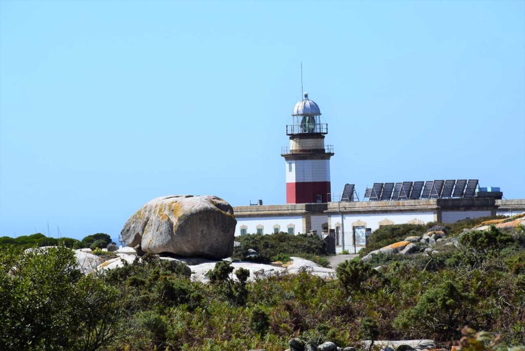
The current lighthouse is located in the southwest of the island in front of Punta Besugueiros, replacing the old lighthouse. It was inaugurated in 1921, after the shipwreck of the "Santa Isabel."
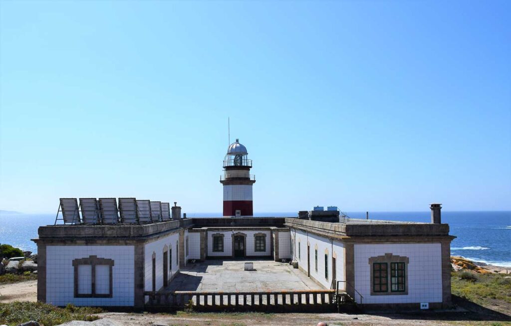
It is a large U-shaped building designed to accommodate three lighthouse keepers and their families. On its rear facade, there is an octagonal masonry tower 12 meters high. Its construction began in 1912 but was not activated until December 5, 1921, due to delays in the lantern installation. It was considered a third-order lighthouse. In 1954, it underwent the last reform incorporating generator sets, batteries, and storage space. Nowadays, it works with solar panels and, until recently, continued under the care of lighthouse keepers.
The old lighthouse was built in 1852 as a fourth-order lighthouse with white and red lights that illuminate up to 10 miles, and it was located at the same enclave of Punta Besugueiros. Attached to it, it had some rooms for the lighthouse keepers, a warehouse, and a hexagonal tower with a small balcony and a turret.
The views from the lighthouse are across the open sea from where the Island of Ons is visible, which is an archipelago that also belongs to the Maritime-Terrestrial National Park of the Galician Atlantic Islands. At a closer look, one can appreciate the cliffs of the neighboring island. To the left of it, there is a panoramic view of the coastal area with specific sceneries such as the magnificent beach of La Lanzada and the exceptional St. Vincent Cape of O Grove; the rest of the peninsula is visible as well.
To learn more
To reduce the continuously growing maritime traffic, in 1902, through the Maritime Lighting Reform Plan, Authorities studied the need for the lighthouse to illuminate the interior of Arousa estuary, improving the management of such amount of vessels.
Ramón Martínez de Campos was in charge of this project and chose an area near the old lighthouse enclave where the light would pass from being 24 to 40 meters above sea level.
It is a large U-shaped building designed to accommodate three lighthouse keepers and their families. On its rear facade, there is an octagonal masonry tower 12 meters high. Its construction began in 1912 but was not activated until December 5, 1921, due to delays in the lantern installation. It would be a third-order lighthouse.
For navigation purposes in foggy days, a radio-beacon began operating in1925. Later in 1930, the building was tiled respecting its original red stripe, and in 1978, the attached houses were renovated.
The remains of the old lighthouse were given a decorative use to adorn Santa Catalina’s fountain, to function as a laundry room, and to add some towers to the warehouse.
The fountain of Santa Catalina is located on the road towards the island's village. It has an inscription that reads, "Virtuous Water gives Health and Strength." According to tradition, women, who wanted to get pregnant, drank from this water source.
To know it better
The island of Sálvora was a haven for pirates and buccaneers until the 19th century. Nowadays, it has a spectacular landscape, with beaches and dunes surrounded by marine flora and fauna. In addition, it has a lighthouse to alert the boats about the proximity to land since this is a dangerous area well-known for tragic shipwrecks like that of the Santa Isabel in 1921.
The 1852 primitive lighthouse stop working due to the Lighting Plan reform of 1902. The current one dates back to 1921, the year of the notorious shipwreck of the Santa Isabel steamer. It has astonishing views of the open sea. The Port Authority of Vilagarcía de Arousa is responsible for all the renovations. It has an octagonal tower covered with white tiles and a red stripe and a U-shaped annex building with several solar panels.
Ribeira is a county in the province of A Coruña that has one of the most important fishing ports in Galicia. It belongs to the region of North Arousa and is divided into the following areas: Aguiño, Artes, Carreira, Castiñeiras, Corrubedo, Oleiros, Olveira, Palmeira, and Ribeira.
Facing the mouth of the Arousa estuary, right in the town hall of Ribeira, we find the Island of Sálvora. It is included in the National Park of the Atlantic Islands and is the only one that belongs to the province of A Coruña.
Gallery
Location
- Locality
- Ribeira
- Municipality
- Ribeira
- Province
- A Coruña
- Country
- Spain
The asset
- Type
- Island
- Eco-destination
- Ría de Arousa
- Environment
- Natural
- Relevance
- International
How to get there
- Access
- By sea By land
- Distance
- 1,200 km
The visit
- Visitable
- Yes
- Interpretation
- Information panels and signage: The National Park has a welcome information panel in Sálvora at the end of the port. It contains a specific map of the archipelago, with points of interest and authorized itineraries, as well as a general map with the situa
- Accessible
- No
- Parking
- No
Coordinates
- Latitud
- 42.46588200
- Longitud
- -9.01317700