
Sálvora Island. The village and its ancient granaries
About this heritage
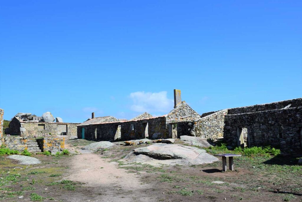
The village is located north-east of the Sálvora island, above “Punta Pernapraba”. It is in ruins although some houses have been restored keeping its orginal shape. The Salvora island has been declared Asset of Cultural Interest (BIC) Cultural Landscape.
It is u-shaped in order to shield itself from the wind and the north. It is a very unique type of architecture, not being many other of its kind left. The houses are of a single plan and its wooden walls share party walls. Some of them have a little entrance garden. Its u-shaped design leaves a central space as a community yard. Such a space would probably have been used as the spot where the animals were fenced, the so-called “curro”, since it was feasible to close both at the entrance and the exit of the village.
Inside the houses the main room is the kitchen, which used to have a stone oven and an iron cookware, the most modern of them. They might have been conformed with one single room, probably restored eventually , dividing the space with bricks to make up alcoves and concrete shelves in order to make the food storing easier in the kitchen. Perhaps they even set concrete chimneys in order to help the smoke out .
Its inhabitants left lots of their belongings behind when they abandoned this island, belongings such as beds, chairs, bottles of wine, chimneys and sinks, as well as granite cooler.
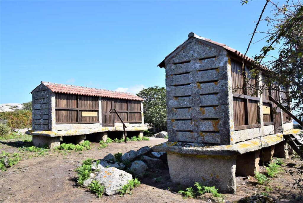
The house that someone once called “The light factory” still keeps the rusty generators in which you can still read the relief letters of the manufactures: “HMP Riveira” and the basque “Onenea”, founded by Jose María Lasa. Next to it, in a store house some rust has eaten away the chassis of a tractor whose engine used to be turned on to reinforce the electric production. The village also counts with an old granary called “hórreo”, kind of a storehouse closed-based and made of Stone. They usually have crosses and pinnacles and a double-pitched roof.
To learn more
There is no data or evidence of settlements of primitive people such as celts, romans or suevi. During the high middle age, the island was donated by Alfonso II the chaste to Santiago´s Church. But there is no evidence that there was any construction of a church on the island.
During the late middle age, the island was used as a base camp for invading attacks such as the ones from Vikings and Saracens, which made a stable settlement impossible.
Later, when the fighting ceased, people from the coast moved to Sálvora for the benefit of their lands. The church gave the island to Marcos Fandiño Mariño in the 16th century. He established a feudal regime until the beginning of the seventeenth century by which the settlers delivered part of their crops and livestock to the master.
Between 1770 and 1779 a drying and salting fish factory was established known as “the warehouse” as well as a tuna fishery in 1789, which was given the exclusive use of the island four leagues around.
People form the coast populated the island and grouped in the village, living together several generations in some of the houses. They didn’t have a church so all the celebrations took place in Aguiño´s parish, where the island belongs. They didn’t have school neither, but the lighthouse keepers were good teacher. They cultivated corn, rye, potatoes, and each family had 7 or 8 cows plus sheep, chickens and rabbits, all for self-consumption. They finished with their domas, this fishing was not subject to sharing with the master and was his source of income.
In 1820 Isabel de Mariño, heiress of the island married Ruperto Antonio de Otero and with them the saga of the Otero family became the new owners of Sálvora.
At the beginning of the 20th century, the state expropiated the island for reasons of national defence and kept a small military endowment there until 1958. In this new situation, the settlers became settlers of the state without consideration, which allowed them to improve their lives. Reform their houses, new stables, better boats…
When the army withdrew, the former owners recovered the island. They introduced animals for the exercise of hunting that spoiled the harvest. The islanders began to leave because of better work on the coast and is not until the 70s when it was depopulated.
The owners moved to the old factory known as the “Warehouse”, reformed it and make it look a little bit like a “Pazo” (big country house for the novelty) and also transformed the tavern of the island in a chapel, renaming it as Santa Catalina chapel.
They used the island as a hunting ground until this activity was banned by the administration.
In 2002, it was included in the statement of National Park but it wasn’t until 2007 when the whole territory becomes public heritage.
To know it better
Ribeira is a village in A Coruña´s province that treasures one of the most important fishing harbour in Galicia. It belongs to North Arousa and it is divided into the following parish: Aguió, Carreira, Castiñeiras, Corrubedo. Oleiros, Palmeira and Riveira.
In front of the mouth of the Arousa estuary, in the very Council of Ribeira, we can find the Sálvora island, which forms part of the National Park of Illas Atlánticas and it is the only one belonging to A Coruña province.
Sálvora island was a refuge for pirates and corsairs until the 19th century. Today, it has a spectacular landscape. With beaches and dunes surrounded by marine flora and fauna. In addition, in the northern part of the island, we can find the village of Sálvora, which has been uninhabited since 1970. It was a village of farmers and fishermen where we can see house granaries, washing places, remains of mills and an old salting factory.
The island also has a lighthouse that alerts ships of the proximity to land. This is a dangerous area where ships wrecks such as Santa Isabel in 1921 have already occurred.
Gallery
Location
- Town
- Si
- Municipality
- Ribeira
- Province
- A Coruña
- Country
- Spain
The asset
- Type
- Island
- Eco-destination
- Ría de Arousa
- Environment
- Natural
- Relevance
- International
How to get there
- Access
- By sea By land
- Distance
- 1,300 km
The visit
- Visitable
- Yes
- Interpretation
- Information panels and signage: The National Park has a welcome information panel in Sálvora at the end of the port. It contains a specific map of the archipelago, with points of interest and authorized itineraries, as well as a general map with the situa
- Accessible
- No
- Parking
- No
Coordinates
- Latitud
- 42.47431900
- Longitud
- -9.01269000