
The Port of Ribeira. Coastline Promenade
About this heritage
Ribeira is at the end of the Barbanza Peninsula, being the southernmost municipality of the province of Coruña. It borders to the north with Porto do Son municipality in the Muros and Noia estuary and to the south with the Arousa estuary, to the east with Pobra do Caramiñal and the Arousa estuary and to the west with the Atlantic Ocean.
The origin of the city comes from a small seafaring hamlet called "Banda do Rio," which became the capital of the municipality in 1836, thanks to the industriousness of its people. For that reason, in 1906, Alfonso XII granted it the title of "city." Its port developed from the nearby Ínsua islet, which later absorbed by a future expansion.
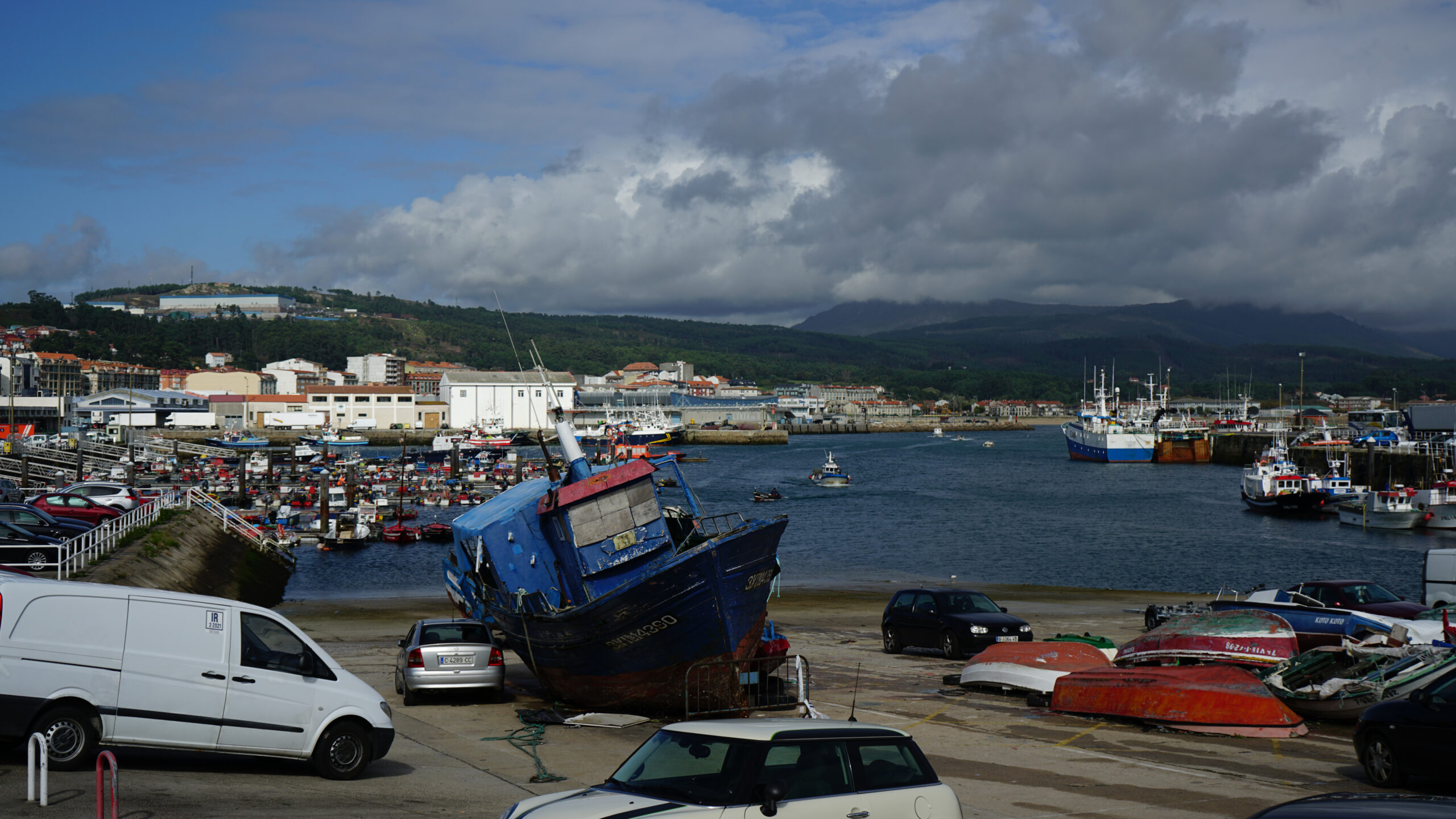
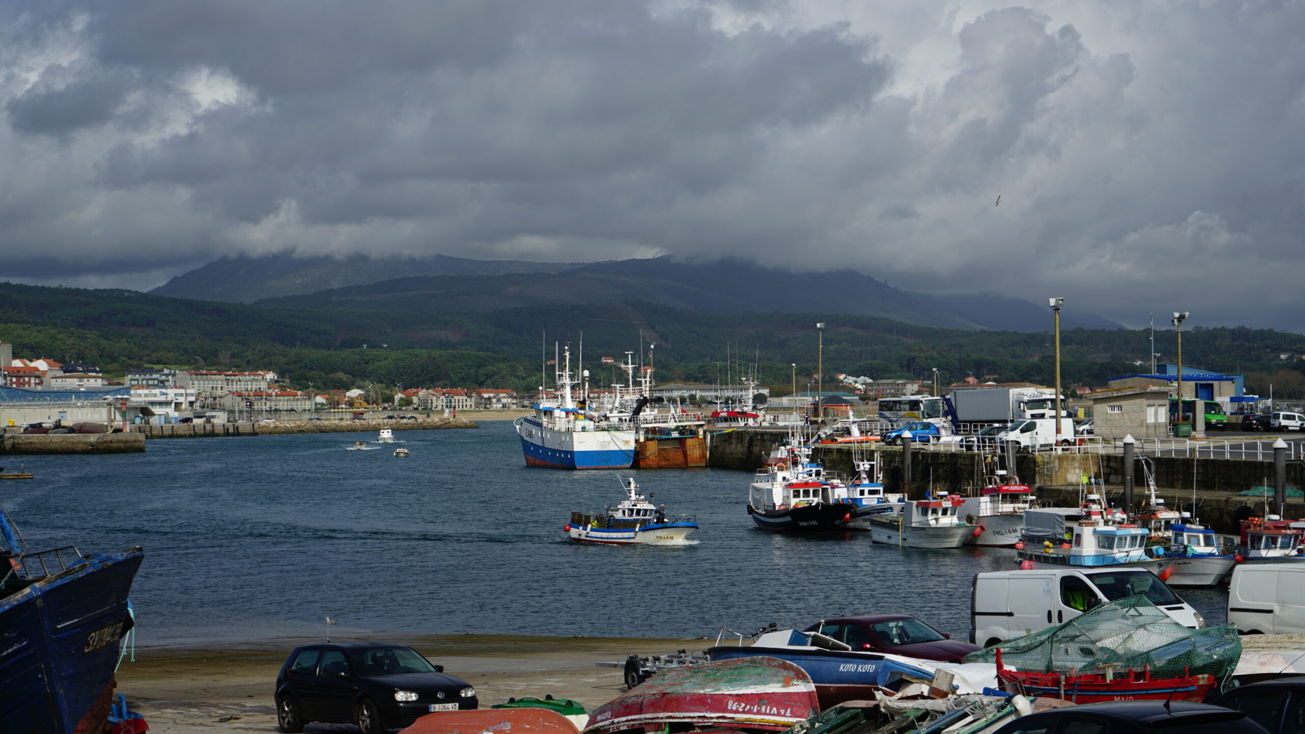
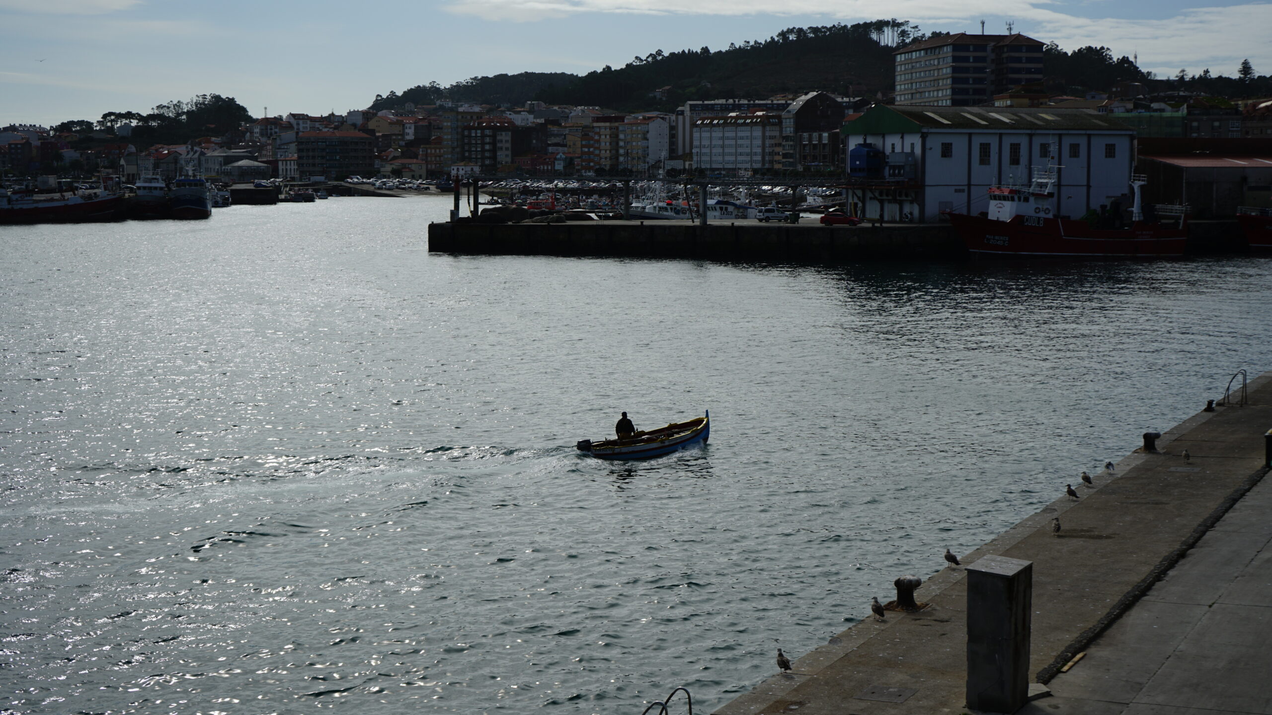
Since the yesteryears, it is an area deeply rooted in the sea as its economy depends heavily on it. It is not surprising that it has become the most relevant coastal inshore fishing port in Spain and the third in Europe, and thus, one of the most valuable on the Galician coastline. Its port occupies an area of 700,730 m2 and covers the coastal strip bounded by Punta Cativa and the Malecón Avenue to the Coroso beach. Within it, several activities coexist; noteworthy are fishing, nautical-sports, and commercial ones.
Its fish market has consolidated in recent years as a reference for sales of species, such as European conger, octopus, and European spider crab. They also sell others of significant tradition, such as Blue whiting, Atlantic horse mackerel, starling, Atlantic chub mackerel, or hake. They auction all the catches in the seven existing sales outlets in the fish market.
As soon as they moor at this port, they classify and tag the fish and shellfish by species and size with the corresponding labeling and store them in conditioned boxes. At the fish market, the auction day begins at 18.00, with the sale of the fish from the traditional boats and trawlers as they arrive. At 21.00, the seine fishing boats dock, and then again at 8 in the morning and at 15.00 the shellfishing boats with clam, octopus, razor clam, among others. At each arrival, they auction the produce, making this market almost 24 hours active.
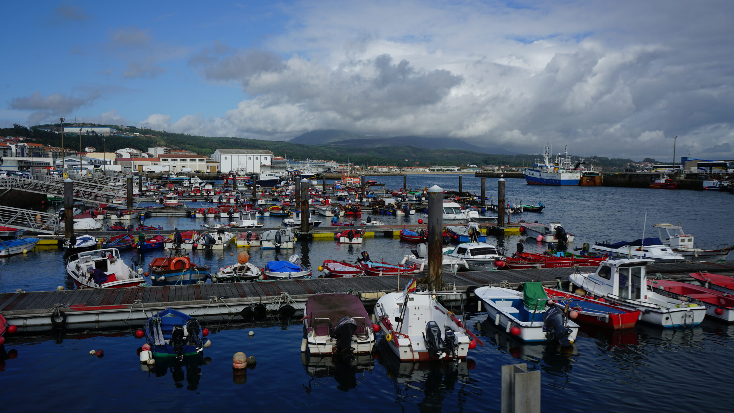
Near the town center is the marina of Ribeira, which offers all the services. Beside is the Coroso Promenade, which extends for almost two kilometers along the fine-sand beach from where visitors can admire the immense landscape of the Arousa estuary. The route is of low difficulty, and the beach has a recognizable blue flag with all kinds of services.
On the path to the end of the estuary, where it joins the Atlantic Sea, there are smaller ports, such as Touro and Ameixida, which connect by a sea path of approximately one kilometer long, linking the Área Secada beach with Ameixida port. This walk is a continuation of the Touro walk, and its route allows travelers to experience impressive views of the estuary by crossing a suspended wooden footbridge over a cliff, giving the sensation of walking on the sea. The small port of Castiñeiras and the Aguiño port, which is bigger and gives the name to the parish, are close to the Atlantic Ocean.
Along the way, there is plenty of indigenous vegetation typical of coastal areas with a remarkable space abundant with cactuses. Travelers can appreciate the views of the Arousa River along the way and contemplate it from the wooden benches located at different points, allow everyone to enjoy the beautiful landscape. For further information, visitors can check some educational panels install along the promenade.
To learn more
Until the 17th century, most of the fishing ports in Galicia had not developed their full potential because of the constant incursions of Vikings, Saracens, and pirates. Seasonally, people emigrated inland for fear of being attacked.
From the 18th century, Ribeira kept continuously growing until becoming one of the most prominent of the inshore-fishing ports in Galicia, Spain, as well as the third in Europe. The economic development goes hand in hand with the arrival of the Catalans, who managed to promote the techniques of fishing and salting, mainly of sardines. They established the first salting factory of Galicia in Sálvora in 1770. From this moment on, they extended to other ports in the area, such as Aguiño, Carreira, Ribeira, and Corrubedo, which would become the most significant base port in the estuary in 1900.
Although it should be considered a hamlet, Ribeira has the title of city. It was King Alfonso XII, in 1906, who granted it to Santa Eugenia de Ribeira this title for the outstanding development of its industry and commerce. It is not surprising that the origin of the city comes from a small fishing hamlet called "Banda do Rio," which became the capital of the municipality in 1836, thanks to the laboriousness of its people.
In 1921, they also awarded Ribeira with the title of "Very Noble, Very Loyal, and Very Humanitarian" for the heroic behavior of its inhabitants in the face of one of the most catastrophic shipwrecks of the time. It was the sinking of the Santa Isabel, whose magnitude was such that people called it the "Galician Titanic."
In 1925, the prominent fishing industry in the municipality evolved thanks to the incorporation of combustion engines in ships. Over the years, it became the first port in Spain for inshore fishing.
In Ribeira, they had established seven preserving factories and many other salting factories focused on the exportation of elaborated products. They had several fishing steamers and several wood sawing factories, as they served large quantities of pinewood for the mines in England and had national and foreign steam lines.
The port emerged from the nearby Ínsua islet, later absorbed by the future expansion. It had a recreational and agricultural society, as well as a center for workers. Built around the main square, the town has a principal longitudinal street and several transversal ones full of lovely buildings, four fountains, and stunning walks.
Currently, the port occupies an area of 700,730 m2 and extends from Cativa Point and Malecón Avenue to Coroso beach. Fishing, nautical-sports, and commercial activities coexist within this space.
The environment of the port acts as an urban promenade. It has a main commercial port dock with a 360-meter long shelter seawall used mainly by the fishing and merchant fleet. To the south, there are a series of buildings for various functions of integrated use with the city, such as the Casa del Mar, the Health Center, and part of the Auditorium.
After the dock, towards the north, the harbor area continues along Malecón Avenue, adequately equipped for different applications, such as transit and parking of vehicles, pedestrian walks, maritime observation points, fishing activities, and access points to water areas. It also has a parallel pier for shellfishing, fishing, and commercial activities, while at the end of the avenue, the zone is for fishing and auxiliary activities.
The Harbor Master's Office (Merchant Navy), the Red Cross, and the tourist information booth are on the side of the avenue opposite the sea. Parallel to the Walk of the Carolinas, the port continues with fishing-use and auxiliary-use facilities, such as the net area, the ice factory, and the fish market. Pass this; the marina facilities begin, with its mooring jetties and piers, its service building, and the cultural association "Lajareu por Barlovento" building.
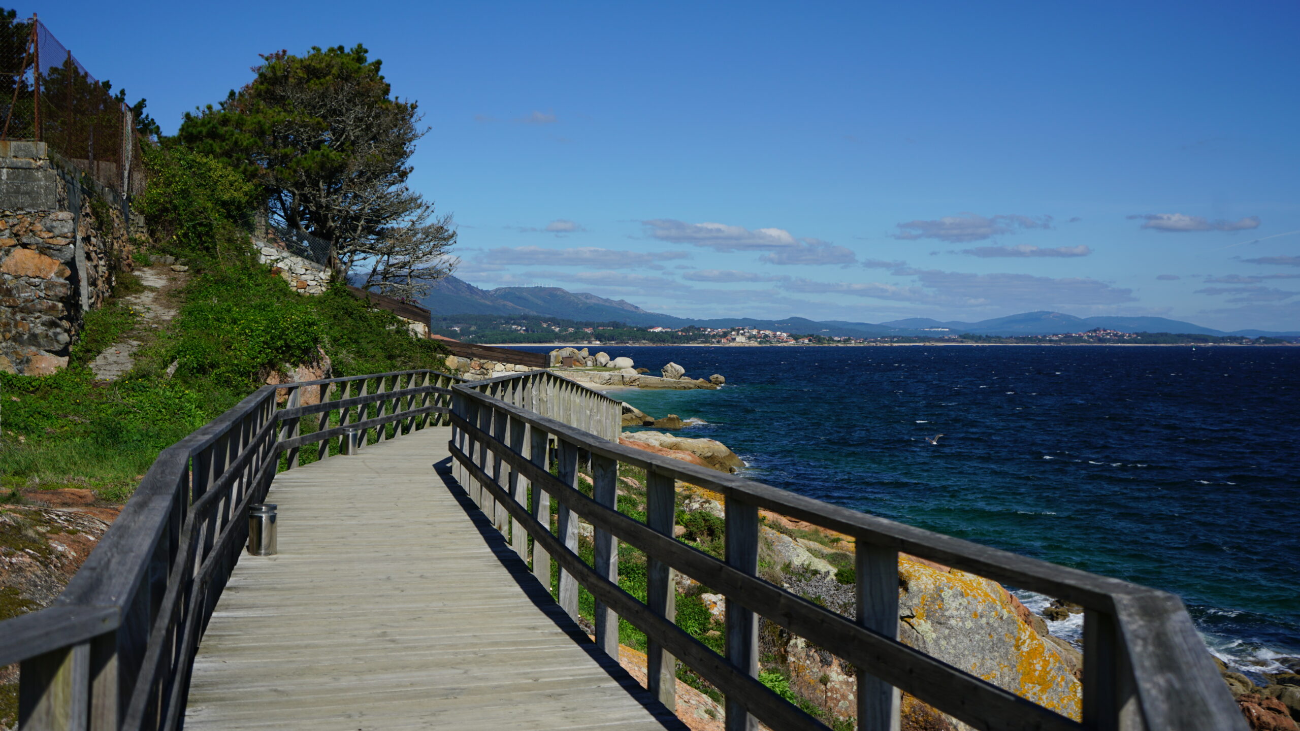
Leaving the port, there is a coastline promenade of approximately one kilometer that runs along the beaches of Touro, Ameixida, and Área Secada. The first section crosses an urban area, passing across a cement footbridge and another one with railings. The promenade continues along Touro beach and has access ramps for people with reduced mobility.
As one goes along the path, the landscape changes, to become a wooden footbridge suspended over a cliff. This structure would give anyone on it the sensation of walking on the sea.
The ample route of this promenade allows travelers to enjoy various views of the Arousa estuary. During the journey, visitors can also find several benches that permits them to stop and contemplate the magnificent landscape. Along the way, there is plenty of indigenous vegetation typical of coastal areas with a remarkable space abundant with cactuses. For those who prefer to go a little deeper into the main characteristics of the environment, there are some information panels available.
This promenade connects with the Aguiño parish and its fishing port, where there are the remains of a Phoenician Quay. Catalans restored it to unload the salted fish from a factory located on Sálvora Island. Right next to it, there are the remains of an old salting warehouse that still preserves part of the stones used to press the fish.
To know it better
Ribeira is a municipality in the province of Coruña with one of the most significant fishing ports in Galicia. It belongs to the Arousa Northern Region and comprises the following parishes: Aguiño, Artes, Carreira, Castiñeiras, Corrubedo, Oleiros, Olveira, Palmeira, and Ribeira.
A few years ago, in this municipality, they started the construction of pedestrian paths along the seafront. At first, they focused on a route from Ribeira to Castiñeiras, with a distance of one kilometer passing through the beaches of Touro, Ameixida, and Área Secada. Thanks to this initiative, everyone can enjoy fabulous views of the Atlantic coast while doing physical exercise. A very relaxing activity, as we leave behind the noises of the city and move towards an open space, to experience a variety of vegetation species, including cactuses, something unusual in the Coruña area.
Given the project's success, during the following years, they have extended the coastline promenade of Ribeira. The last stretch is in the parish of Aguiño, joining Laño with the Covasa pier, also known as the Phoenician pier. An incredible curious place, since, to this day, its origin is not entirely known. On the one hand, some studies reveal that it dates back to the Phoenicians' times, 8th century B.C. since we have proven that they settled in Galicia to engage in trade. On the other hand, there are other documents drawn up by experts that show that the Covasa dock belongs to the remains of an old 19th-century salting factory.
Gallery
Location
- Town
- Riberia
- Municipality
- Ribeira
- Province
- A Coruña
- Country
- Spain
The asset
- Type
- Port
- Eco-destination
- Ría de Arousa
- Environment
- Urban
- Relevance
- International
How to get there
- Access
- By sea By land
- Distance
- 0 km
The visit
- Visitable
- Yes
- Accessible
- No
- Parking
- Sí
- Signposted
- Yes
Coordinates
- Latitud
- 42.55778300
- Longitud
- -8.98769600