
The San Simón Inlet and Promenade
About this heritage
The San Simón cove is within the Vigo estuary, at the mouth of the Verdugo River, between the Moaña, Pontevedra, Redondela, Soutomaior, and Vilaboa counties. It forms an extensive sea plain rich in bivalve shellfish and numerous wintering birds. In its waters flow centuries of history, chanties, pirate attacks, battles, and recent fatal events.
It is eight kilometers long and almost four kilometers wide, which decreases in the Strait of Rande to about 700 meters. Cataloged as a Special Conservation Area within the Natura 2000 Network with an extension of 2252 hectares, of which 94% are coastal marine waters, it has a protection figure as a Special Protection Area of Natural Values (ZEPVN).
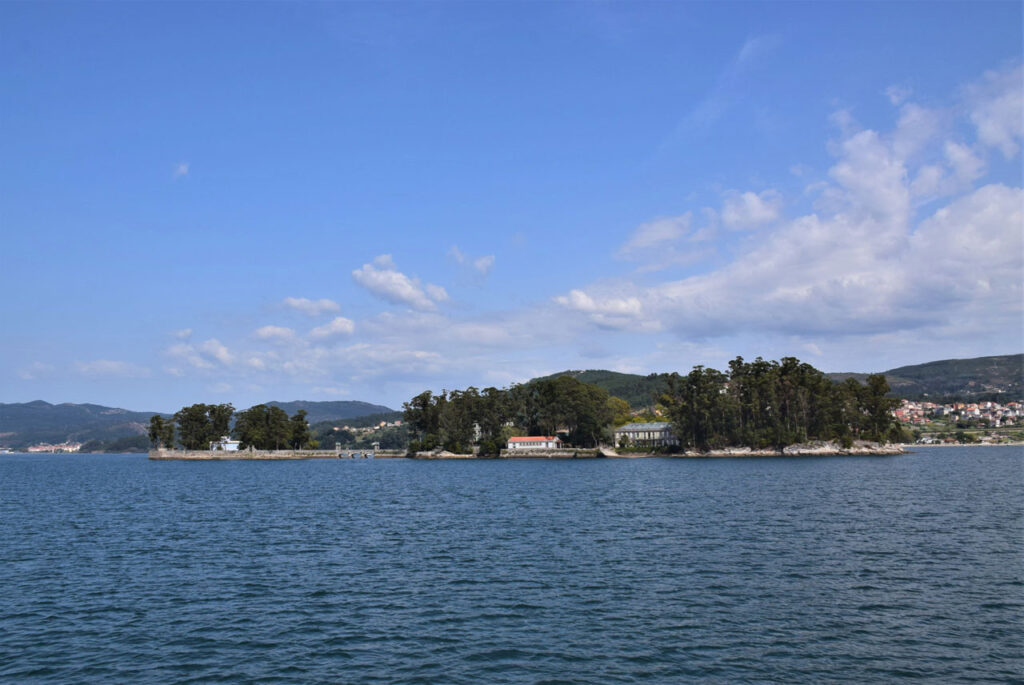
In the northwest part are the remains of some old salt mines, the Salinas do Ulló, currently filled and colonized by vegetation adapted to the salinity. The space includes several rocky islets, namely Alvedosas, San Simón, Lobeira, and San Antón, which are opposite to the mouth of the Verdugo River between Arcade and Ponte Sampaio.
Vilaboa Inlet includes more than 400 hectares of silty-sandy esplanades and intertidal habitats, covered by Zostera sp.
The inlet houses the archipelago of San Simón formed by four islands: San Bartolomé, San Antonio, San Simón, and San Norberto.
On the island of San Simón, centuries of history have followed one another. From the 12th century to the 19th century, various religious orders used it and suffered multiple naval raids.
He was functioning as a Lazaretto from 1838 to 1927. In 1936, the Republicans converted into a concentration camp, which housed more than four thousand political prisoners. In 1948, Franco's guards used it as a shelter. There was a tragedy when forty-three officers in their return trip to the island after watching a football game in Cesantes, died in a shipwreck near Corveiro Island.
From 1955 to 1963, it became an orphanage for the sailor's children, where they learned the trade of the sea. In the nineties, the restoration of its surroundings took place.
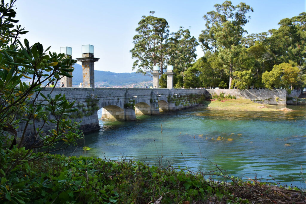
From the promenade, anyone can see the cove. This walkway is about 800 meters long, going from the beach pier called "Finca de Cagazó" in Arcade to the medieval bridge of Ponte Sampaio.
To learn more
One of the most talked-about historical episodes in the San Simón Cove is the famous Battle of Rande. On October 23, 1702, the Anglo-Dutch and Spanish-French alliances fought during the War of the Spanish Succession.
The Spanish galleons arrived at the Vigo estuary loaded with the greatest treasures ever to cross the Atlantic: gold, silver, jewels, and seeds.
Before their arrival in Vigo, in the Azores, a warning informs the Spanish-French fleet that the Anglo-Dutch combined squadron, commanded by Sir George Rooke, was attacking Cadiz.
They had to seek an alternative port and, after several discussions, chose Vigo. On September 22, the galleons and the war fleet entered the estuary.
During one month, the silver and precious metals were unloaded and transported to Lugo in ox carts. They attempted to form a defense, but the lack of time resulted in a poorly equipped and starving militias. They restored with cannons from the ships the Rande and Corbeiro forts, and they dug trenches. In the strait, where today is the Rande Bridge, they formed a barrier with chains, masts, and rods.
On October 22, the enemy navy entered the southern mouth of the Vigo estuary with 160 sail-ships and a disembarking force of 14,000 men. After failing in Cadiz, Rooke expected a glorious victory and counted with a colossal treasure. He got only the former.
The Duke of Ormond landed with 4,000 infantry, who in little more than an hour, destroyed the defenders, and took prisoners while the militias flee.
Taking advantage of a strong gust of wind, Captain Hopsonn's flagship "the Torbay" broke the chain. Followed by the rest of the ships, the intense battle began with cannon shots and without the possibility of maneuvering at the bottom of the estuary.
Some fought hand-to-hand, while shrapnel swept the decks. Others thought only of fleeing by swimming or in a barge. It is then that Chateau-Renault, seeing that the battle was lost, gave the order to burn the French ships. They were all captured, sunk, or burned.
That night the Vigo estuary burnt, and the fire continued until the early hours of the morning.
To know it better
The San Simón cove is at the end of the Vigo estuary. One part of it belongs to the Soutomaior County in Pontevedra and the other to Redondela. In this cove, one finds a wooden promenade just above the marshes.
The Vigo Estuary formed about 15,000 years ago when the sea level rose. Since then, rivers such as Verdugo-Oitavén and Maceiras-Alvedosa have flowed into it and, resulting in the formation of the San Simón Inlet.
In this natural process, different ecosystems and species coexist. Moreover, it is an area classified as a Special Zone for the Protection of Natural Values (ZEPVN), as well as a Place of Community Interest (LIC). It is also part of the Natura 2000 Network for its outstanding protection and conservation.
The inlet of the San Simón archipelago comprises four islands, namely San Bartolomé, San Antonio, San Simón, and San Norberto.
Gallery
Location
- Town
- Arcade
- Municipality
- Soutomaior
- Province
- Pontevedra
- Country
- Spain
The asset
- Type
- Estuary
- Eco-destination
- Ría de Vigo
- Environment
- Rural
- Relevance
- National
How to get there
- Access
- By sea By land
- Distance
- 0 km
The visit
- Accessible
- No
- Parking
- No
Coordinates
- Latitud
- 42.34077900
- Longitud
- -8.61424900