


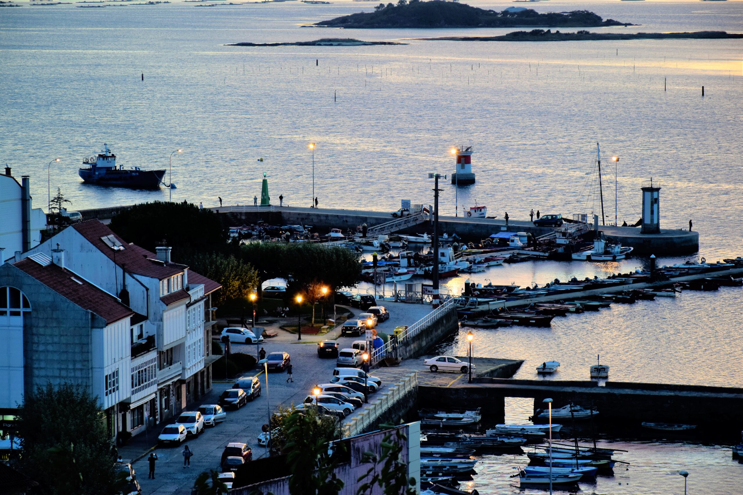
Arosa Estuary. Villagarcía. Carril: Seafaring village, ports and boats, Viking anchorage and clams
About this heritage
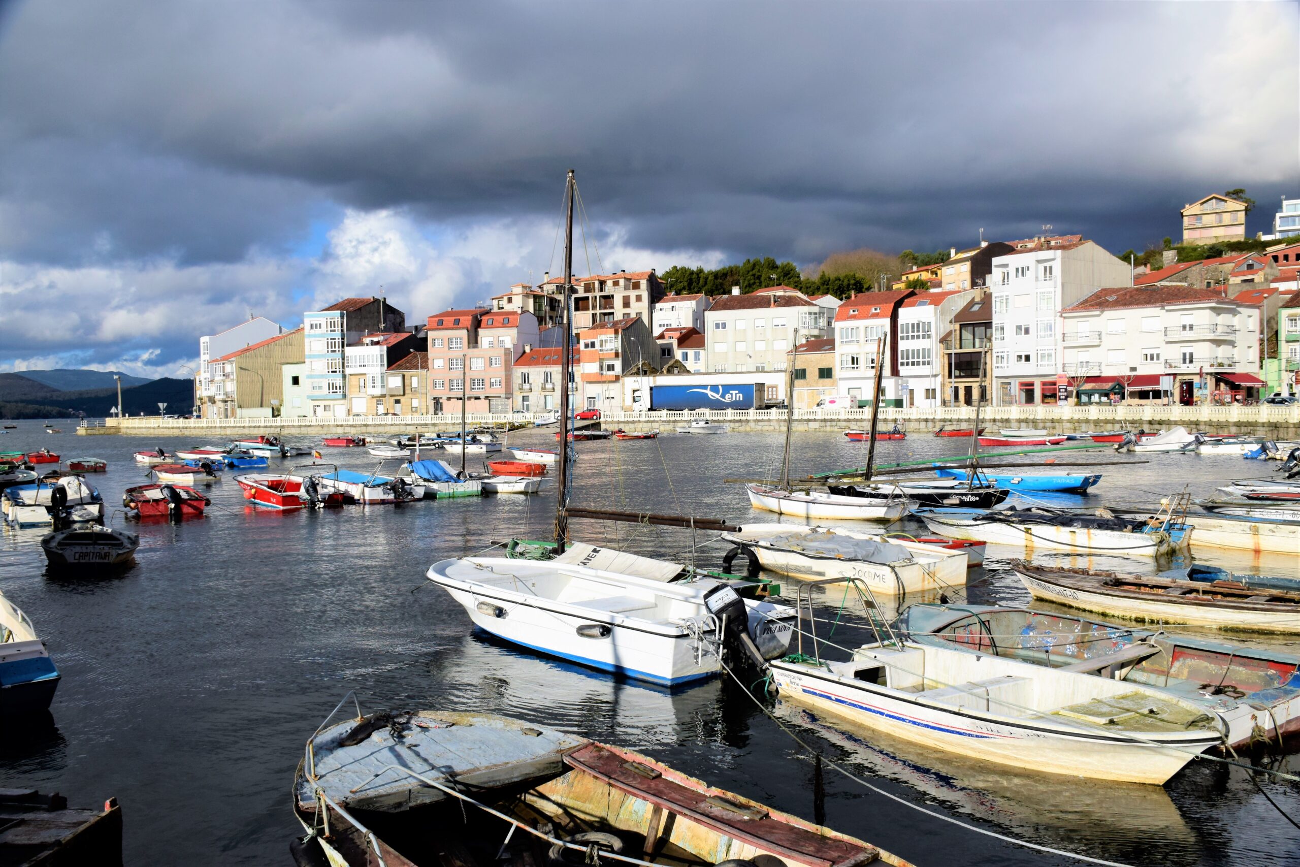
Santiago de Carril, popularly known as Carril, was founded in 1500 as a villa. In 1512, it already had its port, which, around 1750, would become one of the most important in Galicia. In 1814, it was authorized to embark and disembark with America, being an important village with its hospital and its nautical school. It is one of the most famous parishes of Vilagarcía de Arousa in Pontevedra County.
The Carril Port was already functioning since 1512 when its sailors used as a fishing gear the "xeito," which consisted in extending a net along the sea, leaving it between waters, so that the sardines were caught in it. The poorest fishermen frequently employed this system since fewer men and boats were necessary. In 1566, its residents filed a lawsuit against the Brotherhood of the Corpo Santo, from the A Moreira district in Pontevedra for using the encirclement fishing gear. Although at first, the resolution was in favor of the former, the Pontevedra residents appealed and, six months later, the Brotherhood imposed its rules again.
Known as one of the seafood towns of Galicia par excellence, a large part of the population of Carril lives "of the sea." It is also known for festivals, such as the Clam Fair (in Galician "Festa da Ameixa;" in Spanish "Fiesta de la Almeja"), as well as for cultural and historical importance. Therefore, its star dish is clams, which earned it the name of "Clam Paradise." One can still find numerous nurseries of clams and cockles, which are still present thanks to its exploitation.
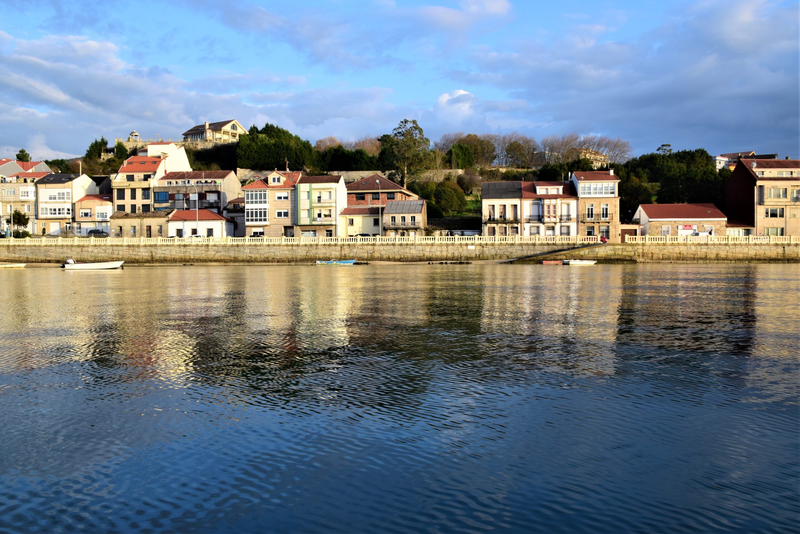
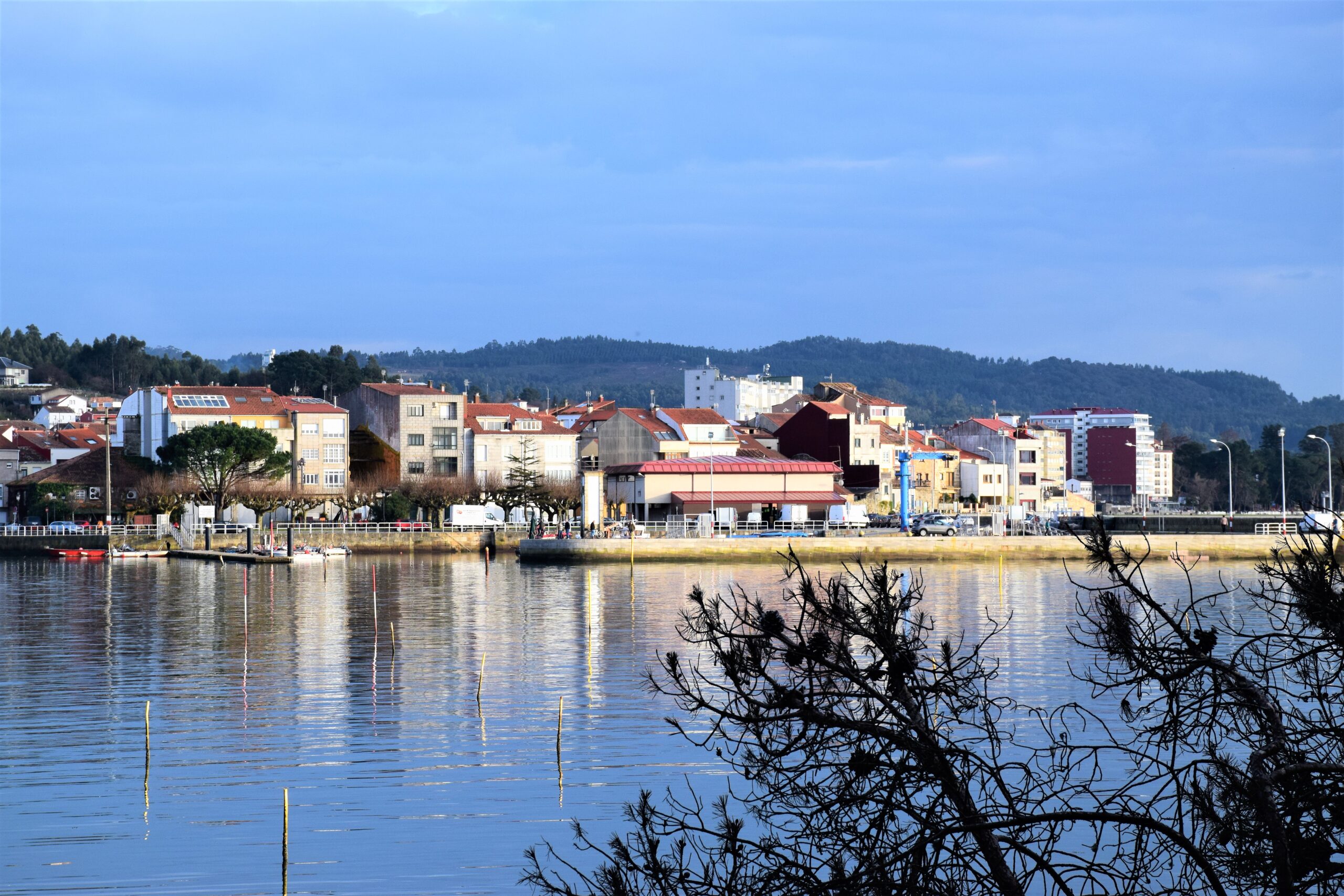
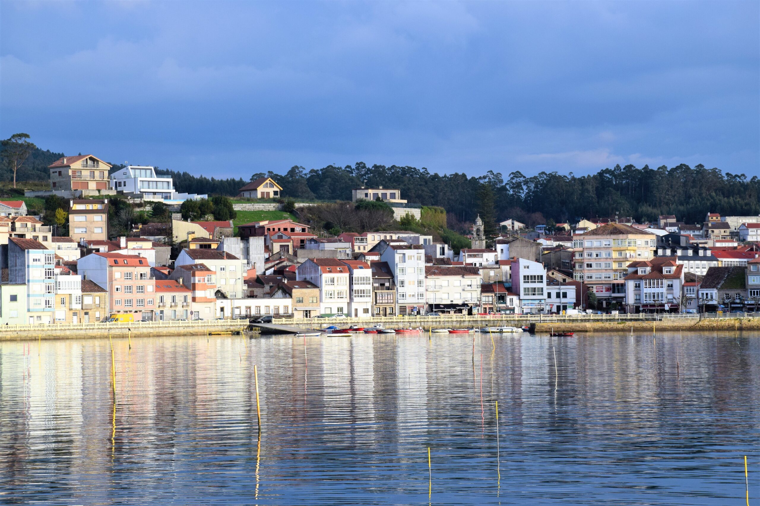
Carril village has always lived by and for the sea. This is reflected not only in its food - based on fish and seafood - but also in its developable structure. Its seafaring district with narrow streets is popular as a major tourist attraction, where visitors can enjoy some of its monuments, such as the church, the chapels, or the stone crosses (cruceiros). Moreover, Compostela Square extends into the town and attracts many locals in summer. The impressive views of the Arousa Estuary from San Roque Mount make it a wonderful worth-visiting setting before leaving the town.
On the other hand, Carril served as a shelter for the Viking invasions. The beaches closest to Santiago de Compostela, where they had their barracks, were a strategic enclave for the Normans. Afraid of the Viking pirates and to militarily contain the Norman and Saracen invasions, the Compostela prelates, whose episcopate was in Iria Flavia, tried defending Santiago by fortifying the city with a wall and by building the Western Towers at the mouth of the Ulla River. During the defensive tower's attacks, the Vikings disembarked and camped in the port of Cortegada Island and surroundings.
To learn more
In 1607, Jerónimo del Hoyo said: "This Carril village was founded a little more than a hundred years ago by some Padrón neighbors, who came to fish where it was founded." Hence, the famous fishing village has always been linked to Santiago de Compostela. In 1801, the bourgeoisie of Santiago set up a second-class customs office.
Between 1840 and 1850, Carril had a population of approximately 2,170 inhabitants. They lived in about 250 houses built on the town, on the island of Cortegada, and two other of its neighborhoods. It was essential for this city the inauguration of the railway section that joined it with Conxo, being the first Galician railway section. However, it began to lose value, when they extended the section towards Vilagarcía de Arousa, being the latter notably ahead of Carril. Another reason that reduced its Port's importance was the substitution of the sail for the steam, so the boats began to carry more load. Because of this situation, Carril Port became too small, and the Compostela citizens swivel their interest to larger cities, such as A Coruña, Ferrol, or Vilagarcía de Arousa. With the enlargement of the latter, they moved the Customs Office and the Shipping Houses, ending with their annexation to Vilaxoán and Vilagarcía in 1913. Carril Port had had value just because they considered it for many years as the port of Santiago de Compostela. By 1844, several commercial houses of Santiago de Compostela -Santamaría, Roig, or De Andrés- had associated to trade with South America to take their products to Padrón, and from there, transport them to Carril through the Ulla River due to the tremendous increase of maritime traffic. Therefore, Carril became, without a doubt, the natural Santiago Port.
The Galician Viking invasions were popular in the Arousa estuary. The Saracens called them, "Maalahmar," whose meaning in Arabic is red water. The name may have its origin in what we know today as red tide, the toxin affecting some mollusks and crustaceans, and significant to Carril since its notoriety for being a land of enormous clams. Cortegada Island became their strategic place and rest point; from there, they ventured expeditions to the Galician interior, and they used it to leave their large ships sheltered until they set sail again. The Normans sought the booty through combat, and Northern European countries had always attributed to Galicia a prestigious mystery of opulence and sumptuous life. In the Scandinavian sagas, Santiago de Compostela City was called "Jacobsland," the land of Santiago.
Since the Vikings could not attack it to plunder and immediately make a successful exit, the adjacent beaches of the apostolic city were an excellent enclave for them. The hills encircling the city, which are what we know today as Carril, rendered a tactical retreat for the Normans. The conditions of its port and the existence of Cortegada Island off its coast were the reasons why many peoples from remote times have visited Carril, such as Iberians, Celts, Phoenicians, Greeks, or Romans. Others were from the middle Ages, Swabians, Normans, and Arabs, as well as invading armies from France and England in the Contemporary Age.
In the first half of the last century, the principal income of the Carril inhabitants came from fishing and seafood resources, besides the port activity, as it could not be otherwise. Besides selling fish at the fish market and perhaps, because of the high supply and low demand, the sailor's wives offered them door to door. Located between Carril and Cortegada Island, the notorious sandbank was called "O Bao" or the "Lombo da Besta." At low tide, it was completely dry; thus, they could divide it into numerous parcels, where the shellfishing workers cultivated considerable quantities of mussel clusters throughout a parcel's length, and underneath, raised the clams. Later, the mussels began to fill the stonewalls that divided the nurseries to make room for the clams and oysters. After the Civil War, approximately between the 1950s and 1960s, the exploitation of seafood on a large scale began in the Arousa Estuary, where the first floating rafts for mussel cultivation appeared. Don Alfonso Ozores, Marquis of Aranda and Lord of Rubianes, was the pioneer of Mitiliculture, building the first rafts with the hulls of old ships, which would anchor near the Ferrazo breakwater. Soon, these ships would be replaced by barrels, and later, with a patent of an industry established in Vilaxoán, called "Atlántica, S.A.," they perfected the support until the present ones, made of a metallic structure. In the middle of the 20th century, mussels were taken to Vilagarcía and other cities. They sold them generally cooked and without shell, as well as oysters, clams, cockles, crabs, and others. Many women made long walks to sell her goods in Caldas, Padrón, and even Santiago de Compostela.
To know it better
Santiago de Carril or Carril is one of the most famous parishes in the municipality of Villagarcía de Arousa. This council is located in the province of Pontevedra.
Carril was founded as a town in 1500 and from 1512 it already had a port. In fact, his was one of the most important ports in Galicia, as it was authorized for embarking and disembarking with America.
As in most Galician ports and seafaring districts. This port has very rich and highly appreciated marine products. The clam is one of them, since this bivalve mollusc is buried in the sands of the banks of the Ría de Arousa.
The port was an anchorage for goods destined for Compostela. The town was also important, as it had a nautical school and a hospital.
Gallery
Location
- Town
- cuyo significado en árabe es agua roja -pudiendo ser que el nombre tenga su origen en lo que hoy conocemos como marea roja, la popular toxina que afecta a algunos moluscos y crustáceos-
- Municipality
- Vilagarcía de Arousa
- Province
- Pontevedra
- Country
- Spain
The asset
- Type
- Fishing neighborhood
- Eco-destination
- Ría de Arousa
- Environment
- Urban
- Relevance
- International
How to get there
- Access
- By sea By land
- Port
- Puerto de Carril
- Distance
- 0 km
The visit
- Schedule
- Arosa Estuary. Villagarcía. Carril: Seafaring village, ports and boats, Viking anchorage and clams
- Accessible
- No
- Parking
- No
Coordinates
- Latitud
- 42.61480800
- Longitud
- -8.77738200